Locational Data and the Public Interest
Citations: M. Goodchild et al., "Locational Data and the Public Interest," in IEEE Transactions on Technology and Society, vol. 6, no. 2, pp. 129-154, June 2025, doi: 10.1109/TTS.2025.3527897.
Abstract:
This article presents a paper developed by the AAG Organizing Committee on Locational Information and the Public Interest through a summit held in Santa Barbara, California in June 2022. The summit resulted in goals and ideas for addressing the issues that arise from the present environment for geodata, whereby public, private, and third-sector entities can tap into publicly available locational information with relatively little regulation on its access or use. The Committee articulates four goals: (1) develop a research agenda extending across disciplines, (2) outline educational resources and strategies to guide ethical practice, (3) devise a pathway to increase public understanding, and (4) create a path to increased dialogue with non-traditional and indirect stakeholders in GIS, as well as increased collaboration between academic, public, and private sectors on the use of locational information. These goals were developed to highlight the host of ethical issues that may arise in the use of locational data, whether for research, commercial application, public administration, communities or any other purpose. Some of the ethical issues are specific to this type of data and will not arise over the use of data that are not locational. Others are common to data sampling, in general, regardless of whether location is collected or not. For this project, the focus is on those issues that arise only when the data are locational. GeoEthics is the term used by this Committee that incorporates geoprivacy among other concepts.
SECTION I.
Introduction
Photo by Mark König on Unsplash
Recent developments in geospatial technologies have prompted growing concern within the research community about the ethical implications of their use [1], [2]. We have reached the point where a largely unregulated mix of government, nonprofit, and corporate agencies have access to vast quantities of locational information that are acquired every day about a significant proportion of the world’s population. Although many of the uses of this information are beneficial and benign, too often they can become intrusive, serve oppressive purposes, or become subject to “function creep” beyond the original purpose, as in the case of COVID-19 tracing data being used in criminal investigations [3], [4], [5], [6]. More recently, the potential for law enforcement and other forms of surveillance of people seeking reproductive medical care out of state has become a reality since 2020. Meanwhile, as smart city applications mature and are adopted by municipalities all over the world, they provide benefits to sustainability, mobility, and economic development, but raise concerns related to privacy and control of the abundant data generated [7], [8], [9], [10].
Even as the ethical and conceptual challenges of locational data intensify, the demand for accredited geospatial professionals is outpacing the supply. Meanwhile, the geospatial industry is innovating quickly and will continue to generate enormous volumes of geospatial data at even higher speeds and of greater variety than at present. The issues that arise from these realities, taken together, need wider recognition by many stakeholders, including individuals, industry leaders, labor leaders and organizers, and the scientific community [11].
Between June 27–29, 2022, the Organizing Committee hosted an in-person Summit (sponsored by Esri), bringing together a breadth of disciplines, including social scientists, computer scientists, humanists, and legal scholars and professionals, to further discuss locational information and the public interest. The participants were brought together by a common concern for the uneven ethical, legal, and social implications of location information. They represent a range of junior to senior positions with different specializations, abilities, and situations, all driven by the goal of more ethical use of locational information.
The eighteen experts at the Summit produced a high-level report that would build a framework for continued and collaborative work, and would target different audiences including academic scholars, educators, public policy makers, certifying bodies, geographic information systems (GIS) professionals, geospatial data scientists, and students across the increased range of disciplines that use locational information. This report addresses four goals, each of which is discussed in an appropriately structured section. The interplay of these goals addresses two transdisciplinary requirements: first, the research gaps and professional training necessary for a workforce to engage in the challenges of geoethics; and, second, the need for public understanding and public engagement in decision making that so intimately affects people’s lives, disproportionately so for people who are often left out of public debates in critical issues related to housing, transportation, privacy, and healthcare [12], [13], [14].
GOAL 1: A research agenda on locational information and the public interest, outlining research questions that extend across disciplines. Discussion under this goal was led by panel co-chairs Mei-Po Kwan and Katina Michael, with comments from three panelists (Mia Bennett, Luis F. Alvarez Leon, and Bo Zhao), and with contributions from participants Michael Goodchild, Trisalyn Nelson (moderator), Markus Kattenbeck (note taker), Toby Shulruff, and many others.
GOAL 2: An outline for educational materials and training goals on the ethics of locational information. These were deemed newly essential for scholars, students, and practitioners, to acquire in order to grasp the social implications of innovation, particularly for those entering or already in the location-based services industry. The materials and goals target anyone who makes use of (or likely will use) locational data, an audience that crosses disciplines (geographers, computer scientists, data scientists, legal, labor-management communities, and more). Discussion under this goal was led by panel co-chairs Jeremy Crampton and Krzysztof Janowicz, with comments from four panelists (Victoria Fast, Joseph Kerski, May Yuan, and Clancy Wilmott), with contributions from participants Peter Kedron (moderator), Zilong Liu (note taker), and many others.
GOAL 3: A pathway that would lead to better public understanding of federal and state regulations around locational information in and outside the U.S. The pathway strategically prioritizes specific publics and recommends how to engage them in order to build broader awareness and agency about federal and state regulation. Discussion under this goal was led by panel co-chairs Richard Appelbaum and William Herbert, with comments from two panelists (Renée E. Sieber and Jeffrey Hirsch) and contributions from participants Daniel Cole (moderator), Kitty Currier (note taker), John A. Wertman, Luis F. Alvarez León, Gary Langham, and many others.
GOAL 4: A pathway to increased dialogue with non-traditional and indirect stakeholders in GIS, and increased collaboration between academic, public, and private sectors on the use of locational information. The pathway identifies the types of stakeholders to engage and new forms of collaboration. Discussion under this goal was led by panel co-chairs Gary Langham and Michael Goodchild, with comments from three panelists (Trisalyn Nelson, Toby Shulruff, and John A. Wertman), and comments from participants Rui Zhu (note taker), Clancy Wilmott, Bo Zhao, and many others.
A. Defining Locational Data
Locational data form the central theme of this project and are defined very broadly as any data including positions on or near the Earth’s surface, in what can be described as the geographical domain. Put very simply, locational data are data involving a “where?” component. Locations might be measured using one of the many available coordinate systems, including latitude and longitude, to an accuracy that depends on the measuring instrument being used. They may also be specified indirectly, by using an established database to connect a named point of interest to a previous measurement of its position. Such databases are commonly termed point-of-interest (POI) databases and are readily available on the Internet. Data about entire areas, such as the State of California or Lake Tahoe, may also constitute locational data, since the boundaries of many areas are also available on the Internet as sequences of boundary coordinates, and the same notion also applies to linear features such as streets, roads, highways, and rivers. Finally, location may also be known in the form of an offset from a monument whose location is already known in the geographical domain. For example, the location of a bear sighting or a forest fire may have been noted as “10km SW of Tolmie Fire Lookout.” The geographical domain roughly extends from 10km above the surface to 10km below. Locational data may include a measurement of elevation above or below sea level, in which case it will be described as three-dimensional (3D) locational data. Many kinds of instruments can be used to acquire locational data. The surveying instruments of the traditional surveyor or navigator, such as the sextant and theodolite, have now largely been replaced by electronic systems that make use of global navigation satellite systems (GNSSs), which include the U.S.-based global positioning system (GPS), the European Union’s Galileo, China’s BeiDou, and Russia’s GLONASS. GNSS receivers have been miniaturized so that they can be installed in smartphones and wristwatches. Location can also be measured by triangulation from known positions, an approach that has been widely used for locating cellphones and WiFi receivers. Bluetooth, radio frequency identification (RFID), and biometrics are also used to establish location through proximity to a beacon whose location is known.
B. Geospatial Ecosystem
It is helpful in these discussions to have a term that encompasses every activity that is founded on locational information, including the supply chains that acquire, compile, and distribute it; the professionals who manage it; the students who study it; the funding that supports it; the profits that flow from it; and the power imbalances that it expands. We use geospatial ecosystem in this report as that all-encompassing term [15].
Two popular technologies feature prominently in the geospatial ecosystem. The term GIS, for geographic information system, was coined in the 1960s, initially as a system for performing a number of simple operations on locational information. Through time these systems have become more and more complex, and capable of performing a host of useful functions that are often termed locational analytics. Numerous textbooks describe GIS, for example, Longley et al. [16]
The term GeoAI, for geospatial artificial intelligence, encompasses the various techniques, tools, and systems that apply artificial intelligence to geospatial problems. These include machine learning, deep learning, and the use of generative AI to simulate maps and images. GeoAI has grown rapidly in importance in the two years since the Summit.
SECTION II.
Methodology
A. Ethics of Using Locational Data
A host of ethical issues may arise in the use of locational data, whether for research, administration, or any other purpose. Some of the ethical issues are specific to this type of data and will not arise over the use of data that are not locational. Others are common to data sampling, in general, regardless of whether location is collected or not. For example, all data about humans raise issues of representativeness: Do these data provide a true picture of humanity or of a defined subset of humanity, or are they subject to some form of bias? This issue will arise whenever data are being used to address social questions, and these considerations are not specific to the locational focus of the Summit. For this project and for the Summit and this paper, the focus is on those issues that arise only when the data are locational. For the purposes of this project, we term those issues GeoEthics. Throughout our article, we often focus on one such ethical issue, that of geoprivacy, although there are numerous others [17], [18].
B. Motivation and Limitations of This Paper
The findings reflect the results of knowledge sharing and discussion during the June 2022 Summit. As such, it documents the participants understanding and perspective at a critical point in the evolution of locational data and their applications. At the time of this Summit, very few such gatherings—that pre-Generative Artificial Intelligence is, with a focus on the ethical issues raised using locational data and their remedies—had yet taken place.
Our focus during this Summit was, therefore, to surface concerns, gain a shared understanding, and outline a broad, interlocking set of goals and agendas for moving forward. Given the global diversity, complexity, and dynamic nature of its subject, the resulting paper should be viewed as a framework for action rather than a prescriptive plan.
We hope this article will serve as a flexible resource for scholars and policymakers to initiate their consideration of research, pedagogy, policy recommendations, and civic engagement around locational data. It also serves as a grounding resource for timely and evolving approaches to this dynamic area of inquiry and action.
SECTION III.
Goal 1: Research Agenda on Locational Information and the Public Interest
The first goal of the Summit was to identify a research agenda on locational information and the public interest, outlining research questions that cut across disciplines, examining the ethical issues that could be addressed to improve the current challenges in spatial analytics, and identifying knowledge gaps that were not yet holistically documented. Prior to the Summit, the AAG and its partners hosted a series of interdisciplinary webinars, some of them half-day workshops, that focused on GeoEthics and the Public Interest [19]. These multi-disciplinary, multi-dimensional discussions called upon a wide range of practitioners—in academia and government, the private sector and the community—to provide insights that informed the summit’s charge to address the implications of ever-more precise technology for geolocation and the ever-more pervasive panopticon of public life. Many issues were raised, for example, bias and harm to racialized communities. Seven groups of agenda items were identified, including (1) Privacy and Anonymization, (2) Data Technology and its Social-Psychological Dimension, (3) Utility, (4) Technical Approaches to Privacy Protection, (5) Data Infrastructure: Virtual Data Enclaves and Processes, (6) Co-Design and Inclusivity, and (7) Ethical Implications of the User Experience.
For this goal of the Summit, we also acknowledge the contribution from the individuals below, who supported the early development of Goal 1 prior to the Summit: Roba Abbas (University of Wollongong); Ada Lai-ling Chung (Privacy Commissioner for Personal Data, Hong Kong); Yu Liu (Peking University); and Douglas Richardson (Center for Geographic Analysis, Harvard University).
A. Introduction
Several overarching issues should first be identified, as they impact the development of a research agenda. First, to what extent should a research agenda address the interests of the private sector, in so far as these differ from the public interest? Private-sector investments in locational information are growing rapidly, and the sector is very active in advancing the frontiers of knowledge and technique. But the results of much of this research are often closely held. On the other hand, research in the academic community tends to be more open, and results are more widely shared.
Second, the terms “data” and “information” are often used interchangeably, but from an ethics perspective it would be advisable to distinguish between them. Information can be defined as data that are fit for purpose, implying that purpose and use cases, will always be important in any discussion of information. Purpose is a pervasive theme in much of what follows, as is context.
Third, it is important to recognize the differences that exist between varied perspectives and distinct communities over what constitutes knowledge. Knowledge of land use and ownership varies substantially between cultures. For example, the assumptions made in the design of today’s geospatial technologies may be quite unsuitable for application in some indigenous communities. In essence, a research agenda will need to recognize the importance of plural epistemologies.
Fourth, it is possible to conceive of two entirely different approaches to research on ethics in this context. On the one hand, the approach might be normative: to identify an ideal set of rules that would govern the use of locational information and to research the ways and means by which that ideal set might be adopted. On the other hand, the approach might be empirical: to observe and catalog actual behaviors, and to describe the differences between them and an ideal set.
Fifth, it is important to recognize two approaches to locational information. One approach sees location as a problem of measurement, using devices such as GNSS receivers, and has at its core a system of coordinates such as latitude and longitude. But people in their everyday lives pay little attention to measured location, instead using a system of named places and retaining associations with these names in their minds. This second, more human-oriented approach to location raises questions about uncertainty that humans resolve through negotiation (“Which Springfield are you talking about?”), and computer applications may try to resolve through autocorrection and suggestion (by suggesting the largest Springfield, or the nearest, or some compromise between size and proximity).
The following sections include a number of research questions. No claim is made that the list is complete, but each of the questions has been selected as being researchable and likely to yield useful results in a reasonable timeframe.
B. Privacy and Anonymization
Several systems to preserve privacy are already in use. In the U.S. health sector, the Health Insurance Portability and Accountability Act of 1996 (HIPAA) forbids the sharing of 18 attributes that could identify an individual, including name, date of birth, and address. Data on individuals that are collected by the U.S. Bureau of the Census must be aggregated to reporting zones such as counties or census tracts to protect confidentiality or be stripped of locational information. Today, vast amounts of data are being collected through apps and social media and stripped of identifying information before being aggregated and sold. But a “ping,” consisting of no more than a location and a device ID, can nevertheless be readily de-anonymized or reidentified by the simple expedient of linking together all the pings from a single device. Several techniques have been developed to protect privacy, including aggregation and random distortion of locations (geomasking) [20], [21], [22], [23]. Yet gaps remain in knowledge about personal privacy protection, suggesting several possible research questions:
When the government collects or uses individual-level locational data to serve specific societal or policy needs (e.g., COVID-19 control measures), what methods provide the best privacy protection while providing useful and comparable results?
When individual-level locational data are collected or acquired by the private sector, and sold or transferred to others, what arrangements are needed to ensure that privacy is protected?
Under what circumstances can governments or relevant public agencies be allowed to access these data while protecting people’s individual locational privacy and rights?
What is our responsibility regarding the use of location as an identifier when protected categories such as race or religion can be inferred from it?
C. Data Technology and Its Social-Psychological Dimensions
While the measurement of location is now straightforward thanks to GNSS, many other aspects of the acquisition of locational information are more problematic, especially those involving the acquiescence of humans. Willingness to provide locational information is likely to be influenced by attitudes and behaviors that are the domain of social psychology [24], [25], [26]. Moreover, the experience of COVID-19 vaccination has shown how important those attitudes can be. The following research questions are suggested to fill gaps in current knowledge:
How would different methods of data collection and usage affect people’s acceptance or willingness to provide the needed locational data?
What factors affect the extent to which people are willing to cooperate with the government in these endeavors? How would these factors (e.g., risk perceptions, trust in the government, cultural factors) undermine the effectiveness of government measures or policies?
What can we learn from other fields about distrust of government, and how might this be useful in understanding concerns over the collection, analysis, and sharing of geospatial data?
How can the government or relevant public authorities balance the need for collecting these data, in the interests of public safety and national security, with individual geoprivacy protection?
What risks do people perceive when their locational data are given away or shared?
D. Utility
Vast quantities of locational information are becoming available, but data only acquire value when they are shown to be fit for purpose. Thus, in developing a research agenda on locational information, it is important to be aware of the uses to which they are being put and uses that are likely to develop in the future. The following research questions are suggested:
How much research is being done on locational data, and for what purposes?
Are the general principles of science being violated in using these data? For example, are the processes of data acquisition fully transparent, are uncertainties fully understood, and are they being propagated throughout the analysis of the data? When inferential methods are used, are the assumptions of those methods valid?
How can we build strong relationships with private companies to make their locational data accessible for research?
What standard data products should be created and made widely accessible to satisfy research needs?
Can the complex innovation ecosystem in location services be described and modeled, along with the value chains of location-based services? How can the accountability of stakeholders in these value chains be ensured?
What biases, exclusions, and systems of power exist within the geospatial ecosystem?
E. Technical Approaches to Privacy Protection
Two methods are commonly used to ensure privacy and confidentiality in the use of locational information. Aggregation to reporting zones is the approach preferred by the U.S. Bureau of the Census and other statistical agencies, which prohibit the distribution of statistics when the number of individuals reported in a zone is below an acceptable limit. Geomasking replaces measured locations with randomized ones within a defined distance or neighborhood [20], [21], [22], [23]. Each method has its advantages and disadvantages in specific use cases; for example, geomasking will prohibit any analysis that involves distances between locations [27]. The following research questions are suggested:
What are the most commonly used geomasking methods applied to individual-level locational data for the protection of privacy, and in what use cases?
How effective are different geomasking methods in protecting privacy?
How effective are novel methods using artificial intelligence (AI) in protecting privacy or deanonymizing locational data?
What are the trade-off patterns between privacy protection and analytical accuracy, and in what use cases?
F. Infrastructure: Virtual Data Enclaves
A virtual data enclave can be defined as a system that provides authorized users with online access to confidential data for the purposes of scientific research, prevents any downloading or sharing of the data outside the enclave, and ensures that the results of the research do not reveal any information about individuals and their locations [21]. The Census Data Centers program of the U.S. Bureau of the Census achieves these goals by sequestering researchers in specially designed spaces; a virtual data enclave could achieve similar ends online.
What are the essential components of an effective infrastructure that facilitates the sharing and use of individual-level locational data to address the public interest?
Is it possible to create and implement a robust and reliable system to provide a secure yet accessible environment for the government and public agencies to share, use, and analyze these data?
What should be the core capabilities (e.g., different geomasking and encryption methods) of such an infrastructure or system that would help anonymize and export maps, queries, and visualizations derived from analysis conducted in the system?
How to ensure users of the infrastructure or system receive adequate training on data confidentiality ethics and the strengths and weaknesses of different geoprivacy protection methods?
What systems are in use around the world, what agencies support them, and how do they compare as part of a research infrastructure? What can we learn from the successes and failures of data trusts?
What are the vulnerabilities–for example, potential for breaches, or exploitation by data brokers? How can we protect the data and what are the sanctions for violators?
What are the limitations of use when stakeholders adopt very big de-identified location datasets to pre-train large language models (LLMs)?
G. Infrastructure: Processes of Data Privacy
The previous sections have addressed technical aspects of an infrastructure for privacy protection, including geomasking, aggregation, and virtual data enclaves. As such an infrastructure develops, it will be necessary to devise and maintain processes that make use of it. The following questions are suggested as researchable topics in this area:
How can awareness of the need for privacy protection be incorporated into the professional codes of ethics of various communities?
What fundamental ethical requirements (e.g., right of informed consent, respect for data protection principles where personal data privacy is concerned, the requirement to share research results, and the need for benefits to the community) should be included in such professional codes?
How can ethical concerns specific to the use of geospatial data and technologies (e.g., GPS) be incorporated in codes of ethics in order to address the public interest (e.g., privacy, confidentiality, data collection and analysis, community interests, and ownership of information)?
What potentially problematic applications should be specified in the code of ethics (e.g., automatic tracking of peoples’ locations and movements)?
H. Co-Design, Public Participation, and Inclusivity
Most of today’s geospatial technologies are being developed in the private sector, and it is often difficult to know the extent to which the general public and affected communities have been involved in the development process. In some extreme cases, technologies may have been designed with the deliberate intent to disrupt and with no involvement of the public. Apple’s iPhone is often cited as an example of a hugely successful technology for which there was little if no previously expressed demand. In contrast, the principle of co-design argues for a more ethical process with the “human in the loop,” in which eventual users form part of the design process from the start [85]. To achieve greater public participation and inclusion, a number of research questions will need to be resolved:
How are humans currently involved in the design and development of geospatial technologies, and which individuals and groups are involved in particular? There may also be a growing need to go beyond humans, for example in the ethical design of geospatial technologies for research into animal behavior.
Can research achieve a greater understanding of the complex innovation ecosystem in location services, and articulate example value chains for given service offerings that ensure stakeholder accountability?
How can diverse stakeholders, including users, be incorporated into the design, development, and delivery of location services through methods like participatory design and co-design? As technologies change, are there new methods of participation in locational technologies?
Is it possible to develop a human-centered approach that can uncover the lifecycle of locational information and the interests of the involved public?
I. Ethical Implications of the User Experience
Users experience geospatial technologies in many different ways, which raise numerous questions of ethics. In the early 1970s, GIS was designed to perform just a few functions on geographic information, but the user was left to select and combine these functions to achieve desired results. As GIS has evolved and as more and more functions have been added (e.g., today’s ArcGIS Pro from Esri offers a list of functions that runs into the thousands), the basic user experience (UX) remains the same: it is still up to the user to select and combine functions to achieve a given end. In other words, the GIS provides the means, but the user is left to define the ends. For example, the same system might be used in support of benign research into human spatial behavior in a city based on anonymized records, and simultaneously used for surveillance by tracking individuals without their knowledge [28]. The following are examples of research questions that might explore this situation:
Can GIS and GeoAI be redesigned to limit the user experience and discourage unethical uses?
How can greater attention be drawn to the power of emerging and advanced technologies and their potential for multi-use applications?
J. Conclusion
Many new technologies follow a predictable path, and geospatial technologies are no exception. The technology first appears in a burst of enthusiasm, as potential users recognize that something previously thought impossible can now be achieved. That enthusiasm powered GIS through the 1960s to 1980s, and it is still powering GeoAI today. The ethical implications emerged later and led to a period of skepticism and retrenchment, as occurred for GIS in the 1990s with the critique that identified and drew attention to the negative societal impacts of GIS [29]. A similar period of retrenchment may already be occurring in the case of GeoAI as the set of ethical issues continues to grow and as geospatial technologies continue to develop [30], [31]. The research questions identified in this section are certainly not complete, but they point to a growing need for new research.
SECTION IV.
Goal 2: Educator’s Guide to Integrating Location Ethics Into the Curriculum
A. Introduction
What knowledge should students and practitioners acquire about the ethics of locational information? From a broad literature, two texts that address this question include Janowicz [31], and Thatcher and Dalton [32], among others [33], [34], [35].
This second goal of the Summit focused on the social implications of innovation, particularly for those entering or already in the location-based services industry. The materials and goals should target anyone who makes use of locational data, which is an audience that crosses disciplines (geographers, computer scientists, data scientists, cognitive scientists, and more). The developed outline examined (1) the power of location, (2) the role of ethics as conundrums and dilemmas, (3) the use of technology, (4) resources for educators, and (5) responsibility. In this section, we share some key underlying principles to integrating location ethics into the curriculum, present conundrums and core tenets for educators, and explore options for mitigation when harm is done.
Location analytics are a set of tools that are becoming more powerful by the day. With the advent of location analytics on the Web, they are also becoming increasingly accessible, able to be embedded into other technologies, and instantly shareable and viewable by millions of people. Hence, spatial tools, maps, and data can be used by much broader segments of professionals and society than even a few years ago [36]. Web GIS tools depend on geospatial data. With the advent of open-data portal technologies and an attitude that data are a public good and should be made available to all, the amount and variety of geospatial data available today are unprecedented. These tools are becoming increasingly personal as they become connected to the devices that people carry with them and to which they attach meaning. Such personal connection, power, and ease of use bring a profound responsibility to ensure the ethical use of these technologies, in contexts that range from the personal to the professional, and from the grassroots to the global. Is there sufficient and appropriate regulation and guidance provided about the benefits and the limitations of these tools [37]?
We know that in our curricula, educational institutions, and programs at all levels from primary to university and lifelong learning, and across multiple disciplines, it is crucial to educate scholars, students, and practitioners about ethics and about societal responsibilities in the use of locational information [38]. However, with the expanded use and application of locational information, it is often difficult to teach what this responsibility means in action. In this spirit, we emphasize that the practice of geoethics is not a checklist or a code, but instead an ongoing, situated, and critical appreciation of the context in which locational information is collected, analyzed, visualized, and acted upon.
B. Introducing, Understanding, Situating, and Motivating the Location Ethics Curriculum
In our experience, thinking and learning about geoethics in this mode is not well-suited to the siloing of conversations and examples into separated seminars on “ethics.” Neither is it well suited to binaries of “right” and “wrong” choices demonstrated by examples, as if those examples may transpose to all eventualities and all decisions that we might make. Rather, courses that underscore the acquisition of key skills in geoethical decision-making, such as criticality and contextualization; which offer guidance and practice in navigating serious dilemmas; which thread ethical thinking entirely through the syllabus (from the datasets students practice with, to the readings that we choose), tend to be more successful in infusing students with geoethical resilience and adaptability for the future in new situations and unfamiliar experiences. Thus, this document seeks to put forward a “playbook” or “guide” for introducing the geoethics of location into the learning environment.
Successful approaches to embed geoethics in curriculum: We have seen the following successful underpinning approaches.
Integrate conversations and materials about ethics into many of the learning experiences offered in a course, and do not silo them into a single session or lesson.
Avoid setting up binaries or dichotomies such as “right” and “wrong,” or “good” and “bad.” Instead, focus on geoethics as a complex and evolving process between these extremes.
Present the ethical questions arising from locational data, and the technologies tied to locational data, with a critical appreciation of the context in which locational data are collected, analyzed, and visualized, and in which the locational information produced is acted upon.
Present the technologies that collect, analyze, and visualize locational data as neither inherently positive, negative, or neutral but as situated.
Deliberately connect the technologies that produce locational data to their political, institutional, and social past and present.
Open the black box of location technology. Provide a reasonable level of explanation of how the technologies related to location data operate, so that learners can critically engage with those technologies in different contexts.
Attend to structures of political power with an acute focus on how past practices have become present assumptions, and who is drawing power from locational (in)visibility. Who is doing the looking, and who is being looked at? What are the structures of dependence or enclosure that might make someone acquiesce to being located when they do not want to be? What are the historical and present-day conditions that generate uneven public access to locational understanding and agency?
Denaturalize classifications and equivalences and expand on how they shape the way we think geographically. For instance, land is not the same as property, racial formation is more informative than race, and so on.
Use datasets and examples in learning materials that are not only drawn from major government agencies, nonprofit organizations, academic institutions, and private companies but also from the marginalized or those without power. When such datasets are used in conversations about the ethics of gathering or using them, the result can be productive learning experiences about ethics.
When using a project-based pedagogy, encourage the consideration of the ethical questions that arise with each decision made across the project lifecycle. As those ethical questions arise, discuss avenues for remediation or correction to improve future practices and outcomes.
Present and consider alternate applied ethical frameworks (e.g., rights- or duty-based) and use instances where those frameworks clash to generate opportunities for debate and engagement.
2. Introducing the idea of ethics into a learning environment: Techniques for bringing ethical considerations into learning include the following.Begin by raising and contextualizing a general awareness of the extent to which locational data are being collected about the students themselves, and others. We expect many learners to have a broader awareness of the issue, but perhaps to be unaware of some specific issues. The key here is not to make an unresolvable appeal to fear. We cannot simply frighten a learner as this will lead to disengagement. Instead, we should describe the tradeoff between convenience that these technologies provide on the one hand, and on the other hand overcoming the apathy that arises when students feel overwhelmed and unable to act in response.
Emphasize that learners have agency in the geospatial ecosystem and get them to recognize that they are not just those doing the looking but those being looked at. They are both suppliers and consumers of locational data. This is crucial to fostering engagement with ethical questions in this area.
3. Understanding technology as situated: Considerations to raise with students when bringing ethics into classroom discussion.Successful integration of ethics into any learning experience depends on learners recognizing that the technologies that gather locational data are not inherently positive, negative, or neutral. Instead, emphasize that ethics is about asking questions about future outcomes. Knowing how to act in different situations is central to critical engagement with these issues, and to the development of the skills that learners need to make ethical decisions in the future. Highlight the connection between ethics and sustainability.
Technology has long been a driving force for economic development, but many studies unearth impactful consequences to individuals or societies arising from misuses or design flaws that enable or encourage unethical conduct. Technology is not inherently good, bad, or neutral. Ethical considerations of technology should attend to the situation in which technology is conceptualized, developed, advertised, and utilized by whom, for whom, with whom, in what process, and structure of implementation.
Rapidly growing technological applications that exploit locational data acquired through smartphones, Bluetooth trackers, RFID, biometrics, WiFi, and beacon position systems. These devices can serve an important role in business processes in organizations such as in emergency responses, citizen participation (e.g., reporting potholes), and social sensing (e.g., public views or sentiments). A wide range of ethical concerns arises from situations that infringe on trust, privacy, safety, and social justice.
4. Situations of ethical concern include the following:
Users are put in a disadvantageous situation.
Users consent but do not provide informed consent. User agreements are written in small print and are difficult to comprehend.
Users are unaware that their data are being collected (e.g., metadata in photos from digital cameras).
Users are unaware of how their data have been sold to or shared with data brokers or have been fused with other datasets to produce intimate classifications of their lives.
Apps that collect user data by using persistent app clients that force the user to become data annotators by default.
Opt-in by default; multiple steps are required to change multiple settings in order to opt out.
Users are not fully informed of all potential uses of their data in the present or the future, or who or what will have access to their data.
The public’s rights or opportunities are undermined:
Surveillance of individuals by government or private entities.
Commoditizing of users’ locations and tracks.
Digital divides that privilege access by certain groups.
Special populations vulnerable to location exploitation:
Indigenous populations.
Vulnerable populations: minority, social-economically disadvantaged, children and seniors, disabled, unhoused people.
Victims (knowingly or not knowingly being tracked), survivor tracking (stalking) and offender tracking (e-carceration).
Domestic and migrant workers.
Access to locational data and location derivatives:
Who needs access to what data? Is that access justified?
How fine or precise must the data be (in space, time, and attribute)?
How long for the data to expire or to be archived?
How to enable the right to be forgotten?
Sources of situated issues:
The intent of the technology and the diversity of perspectives in its development.
Institutions and power structures.
Government in the name of national security or public safety.
Business in the name of innovation and disruption (e.g., “Move fast and break things”).
Introducing the idea of ethics into a learning environment: Students are motivated when:
They are empowered to collect data in the field on a theme they care about, whether it is litter, dangerous intersections, places where they feel safe or unsafe in the community, community gardens, invasive species, weather, historical sites, noise, plant and animal species, or anything else.
They are empowered to use the data that they have collected in a communications tool, such as an infographic, dashboard, or story map, as a means of explaining the patterns of the data that they have gathered and encouraging action to be taken as a result of the patterns revealed through their fieldwork.
Others are invited to add to the field survey that the researcher has set up, such as on walkable neighborhoods or any other theme, as a collaborative effort.
C. Conundrums, Dilemmas, and Transgression
The view of ethics taken here is that of “critical ethics.” As defined in the UCGIS Body of Knowledge, critical ethics is an attempt to defamiliarize the taken-for-granted [39]. This defamiliarization has a pedagogical goal of first understanding where categories and oppositions came from (e.g., racial categories used in the Census, or oppositions between public and private space), and second, of undergoing a “transgression.”
As hooks [40] describes, the point is not that the student transform into one particular (subject) position or another, but to realize the very possibility of transformation, to transgress received norms (itself a thrilling and fearful experience) and also to live the change in ways that are meaningful to the student (i.e., a praxis). She calls this a “practice of freedom.” We also see these transgressions as potentially a form of transformative experience: “one that teaches you something new, something you could not have known before having the experience, while also changing you as a person” [41]. We are inspired by the statement that “the outcome of a PhD Is not a dissertation but the student.”
We recommend, therefore, that educators build in ways of experiencing ethics to break habits of thought, rather than simply learning ethical principles. We argue that pursuing this pedagogical approach can be facilitated by the presentation and collaborative deconstruction of dilemmas and conundrums. Rather than providing an incomplete list of examples, we emphasize that dilemmas and conundrums that lend themselves to transgressive and transformative educational experiences tend to have at least some of the following features:
The locational data issue presented is linked to a meaningful question of importance, which is collaboratively identified by those undertaking the learning experience and those considering its ethical ramifications, with the possibility that there may be no consensus (i.e., to embrace a minority report).
The locational data issue presented has no clear solution, but rather has several solutions, each of which is unsatisfactory in some way and leaves a residual unresolved; for example, survivor tracking of the survivors of stalking vs. offender tracking and e-carceration [25]. On its face this appears to have a preferable solution, that is, to protect survivors by teaching them how they might be tracked, and how offenders should be tracked, but then this extends the prison system into the home and family.
The locational data issue can be situated in a real historical, social, and political context so that the ethical question apparently at hand can be related to broader concerns.
The locational data issue has some hands-on component (e.g., a dataset that illustrates key issues, or an ethically problematic map).
The locational data issue can be clearly tied to some concepts being taught at the time, or that will recur throughout the wider course, or the student’s professional or personal life. Linking the issue to a recurrent concept helps seed opportunities to return to the issue throughout the course and avoid the silo ing of ethics noted above.
D. 11 Core Tenets for Educators
Students are avid consumers and producers of locational data. As the change agents and decision-makers of tomorrow, it is imperative that they understand that “geo” is not just a series of geographic coordinates but rather that all locational data have a societal basis and are imbued with ethical considerations.
GIScience students become well-versed in the technical aspects of mapmaking and GIS, but they lack grounding in the ethical implications that are inherent in all decisions. These are likely to arise during the cartographic design and GIS design phases of a project and beyond, including making decisions about projections, symbology, classification, and communication and visual tools (e.g., infographics, story maps, and dashboards). We seek to encourage students to critically examine the methods, objects, processes, preconceived notions, backgrounds, representations, and other considerations that they may have taken for granted in the past. This is especially important for less transparent methods such as those from GeoAI.
We are firm believers in hands-on, problem-based learning as a key way for ethical concepts to be grasped, personalized, and applied. Today’s locational data-rich and spatial-analysis-rich world allows instructors to easily incorporate hands-on activities into a wide variety of courses and programs, at every educational level.
Key geoethical concepts that need to be taught include location privacy, but we must not limit the topic to location privacy. For instance, different media types, e.g., text, can be used to indirectly infer location. We also must include data quality assessments, issues of copyright, philosophies of open data, open GIS tools, models, Web GIS, decision-making with GIS, the ethical decisions inherent in all location data handling (projections, symbology, classification, generalization, metadata), communicating mapped information, and decisions regarding whether to share data, methods, and results, and GeoAI possibilities. We also must consider the potential for bias and harm to be induced by locational data.
Hands-on activities need to extend beyond geography and GIScience to applications in the fields of business, kinesiology, health, criminal justice, civil engineering, data science, biology, history, mathematics, and indeed, we argue, any field in which students are analyzing data and considering how to effectively communicate with those data (which, we would argue, is virtually every discipline).
These hands-on activities can and should be customized for students from a wide variety of backgrounds and interests, and in a variety of disciplines and educational institutions.
A wide variety and volume of hands-on learning resources exist [42]: the community does not need to build most of them from scratch, though a few gaps exist that we have identified.
Many resources have been created and curated to provide inquiry-driven and engaging ways to teach about geoethics in a wide variety of instructional settings, disciplines, and educational levels. These resources cover scales from local to global and use a variety of engaging tools and datasets. They can be used in a variety of ways in education—including face-to-face, hybrid, and online—and in discussion, independent and group hands-on work, role playing, and presentation modes.
These resources might also be used to encourage the geospatial community to begin earnest dialog with other disciplines about how location and associated tools and issues apply to these other disciplines. Clearly, much work needs to be done, but ethics provide perhaps fruitful ground with other disciplines to explain the benefits of the geographic approach throughout the academy, over and above the results from the “data-driven” or “tool-driven” methods. Interestingly, the open tech ethics curricula spreadsheet (with 300+ contributions) [43] contains minimal contributions from geography departments. This is another illustration of the lack of awareness and lack of understanding in the academy of the value that the geographic approach brings in teaching and research.
Students should be encouraged to deal with “wicked” or “sticky” issues in a problem-based learning environment. Such issues can foster spatial thinking, systems thinking, and holistic thinking that incorporates alternate ways of knowing, such as those found in Indigenous communities.
These resources also are intended to encourage students and faculty to realize that geospatial technologies are increasingly applied to non-quantitative problems and data. Indeed, GIS was criticized for decades for its overly positivistic and quantitative focus. Even software companies such as Esri have recently expanded their social science tools and perspectives, though much more is needed.
E. Responsibility
This requires:
An acceptance and understanding that the history of locational information is complex, and that the locational tools (from digital maps to GNSS to cartographic theory to statistical methods like regression analysis) that we use regularly today were often developed for military applications, surveillance, or in order to exploit natural resources.
An appreciation that:
Locational information technologies did not have to be developed this way and there is continuously documented resistance to their militarization, surveillance, commercialization, and profit-driven exploitation.
There are ample examples in which locational information has been used ethically, privately, and consensually for the benefit of users.
These examples often foreground social need, emancipation or liberation, and safety or equality, rather than profit, control, and extraction.
A commitment to responsibility for the past and present context of locational information. This includes:
Teaching students to do the reading: read what others have said about the impact of locational information (and spatial analysis methods more generally) on their lives; and keep up to date on contemporary conversations and debates (but not to get swept away by trends and ignore everything else), not just reading in one’s domain. This implies the need for reading and writing critical histories of locational data, or accounts of the present (e.g., as corporatized).
Consider redressing the balance of power by doing counter-mapping, not just learning about it. For example, do a surveillance map of campus or work on a map together rather than individual maps (e.g., using crowd-sourced data collection).
Doing work without glory: taking on difficult, tedious, or behind-the-scenes work that does not get attention but is necessary. This will place obligations on institutions like universities to value such efforts.
Taking opportunities for peers or students who are reviewing the work to comment on the ethical aspects and implications of their work as a means of constructively improving the reparative potential of their work. Here, we are looking for a principle opposite to ensuring ethical work by disciplining students, for example, with plagiarism software checks or penalties for not providing citations.
Developing a “Turing Way” mentality where dedication to open research, GitHub collaboration rather than working solo, mutual aid, and working in teams across disciplines becomes the norm [44].
Sharing databases by, for example, journals requiring submission of methods and datasets, explaining where data came from, discussing why data were chosen, and soliciting reviewers to run the code. Replication is not only central to error identification and correction in a field, but also, for example, to the Mertonian norms and ethics of science.
F. Conclusion
The social implications of any technology are many, but perhaps the implications are even more numerous and deeply personal with geotechnologies, given humans’ roots in space and time, and the appeal and use of geotechnologies. Knowing where you are is as deeply personal and as revealing as your health or financial information. Yet geotechnologies and their use in society and commerce, such as for locational tracking, geofences, and geographical analysis, are not well understood by the public. Also not well understood are how people are differently affected by geotechnologies, how they are subject to these technologies, or how different people are able to use them for positive change. Educators therefore have a vital role to play in embedding the social implications of locational technologies throughout the curriculum, including their ethical and just usages. The rapid evolution of these technologies should not discourage educators from engaging with students about the social implications of these technologies. Educators should embed these engagements throughout the course’s themes rather than relegate the topic to a single class period at the end of the semester. Students should be able to understand how making spatial relations more explicit can improve understanding (spatial is special) and how ethical concepts and questions of data representation and representativeness require relating locational technologies to anticipatory governance (that is, thinking ahead about dual use, mitigation of harm and active stakeholder involvement).
We recommend that educators especially engage with location privacy, open data, sharing results, the benefits and constraints of geotechnologies, and workflows for handling geospatial data (projections, symbology, classification, generalization). These can be taught in meaningful ways that involve hands-on use of the very geotechnologies and geospatial data that are being examined. The resources discussed as a part of this goal and detailed in Crampton [42] provide key ways for ethics to be taught.
SECTION V.
Goal 3: From Ethical Locational Principles to Enforceable Geospatial Regulations
The third goal envisioned a pathway that could lead to better public understanding of federal, state, and provincial regulations around locational information in and outside the U.S. The pathway would identify the publics to be prioritized, and we discuss how to engage them to help build broader awareness and agency about federal and state regulation. Hence, a pathway from ethical locational principles to enforceable geospatial regulations was developed, examining certain essential regulatory parameters, with details to be further implemented at a later stage: (1) Accountability, (2) Public Participation, (3) Resources, (4) Informed Consent, (5) Legitimacy, (6) Necessity, (7) Proportionality, (8) Universality, (9) Prohibitions, (10) Objections, (11) Security, (12) Erasure, (13) Negotiability, (14) Reassessment, (15) Enforceability, and (16) Non-Retaliation. The stakeholders would include private companies and public entities, labor unions, and nonprofits/nongovernmental organizations (NGOs), both domestic and international.
A. Introduction
Geospatial technologies may provide significant public and private benefits. They may enhance safety, improve efficiencies, and help effectuate personal, collective, and commercial endeavors [6]. Yet the development, marketing, and implementation of these technologies typically focus on productivity, convenience, entertainment, and control, without concern for individual or collective privacy, or power imbalances and basic human rights. In the United States today, there is a growing misogynistic weaponization of geospatial technologies to deny reproductive freedom and rights. The increase in remote work as a result of the pandemic has also led employers to expand their use of these technologies to track their workforce. Indeed, “emerging technologies enhance surveillance or control by government, employers, loved ones, or caregivers. Through the collection of location data by commercial enterprises, the most basic democratic rights of dissent and protest… can be easily tracked” [6].
Firms involved in the geospatial ecosystem are often cognizant of these issues, and we acknowledge that ethical standards, while enforceable, can serve as guidelines. Indeed, existing geospatial ethical principles already exist that can be drawn upon for such guidance (e.g., [15]). While robust geoethics can serve as important and useful guidelines, by themselves they are insufficient to hold companies, governments, employers, and users accountable in ways that would compel ethical behavior. What is needed is a system of enforceable regulations that would secure the rights of and respect for geospatial privacy interests of diverse publics.
In the United States, with a few exceptions, such regulations do not currently exist in any substantial form at the federal, state, or local levels. The United States trails behind other industrial countries in studying and responding to the significant adverse impact of geospatial technologies on the power balance and dynamics in the American workplace “Despite the ever-widening gap between the public perception and the legal reality of privacy rights in the American workplace, there has been little movement on the federal, state and local levels in this area” [45]. While European geospatial regulatory frameworks exist that can be drawn upon, these remain incomplete efforts.
Companies whose operations rely on collecting, analyzing, and selling geospatial data in general, and locational information, in particular, often oppose government regulations. They frequently argue that regulations impede the ability to innovate and compete effectively—particularly in such rapidly-changing fields as geospatial technology. The imperative to rely on locational data has both resulted in and been furthered by a concerted effort to normalize its collection and use. In the political and economic sphere this has manifested in a deregulatory status quo achieved by the information technology industry and other firms that rely on locational data. For instance, in the United States, well-financed lobbying—directed at both political parties—has thus far been effective in shielding businesses and employers from government efforts at regulation. Instead, businesses call for self-regulation, pursued by adopting ethical codes of conduct and self-monitoring their implementation.
While the effectiveness of this approach has yet to be studied regarding geospatial technologies, a large body of research shows that such ethical approaches fail even when well-intentioned (all too often they mainly serve to enhance public relations). Businesses typically hire auditing firms to privately report back, then self-publish burnished reports celebrating improved compliance with ethical standards. Simply put, self-regulation does not work [46], [47].
We argue that to successfully assure that ethical practices are achieved, and human rights protected throughout the vast geospatial ecosystem—one that spans borders and cultures—a viable enforceable regulatory system must be implemented. Such a system ideally should be global in scope. For example, it should protect workers, domestically and internationally, from geospatial surveillance, and — perhaps more controversially — assure that any independent contract factories or service centers that produce or utilize geospatial software throughout the supply chain uphold human rights.
In the parameters that follow, we lay out some basic contours of such a regulatory system: it must adequately protect the individual and collective interests, including privacy concerns of diverse publics through enforceable regulations. It also must assure firms’ accountability through independent compliance monitoring, achieve transparency through public sharing of compliance audits, and enable meaningful participation in decisions about the use of systems that potentially cause harm. These are important because an educated (and thereby empowered) public is key to geospatial ethics and regulatory enforcement, not only because informed individuals can make better personal privacy decisions, but also because businesses are more likely to actively pursue exemplary ethical behavior if there is public awareness of compliance failures.
Certain of the concepts outlined below are derived from regulatory elements under the 1995 European Union (EU) Privacy Directive, the EU’s General Data Privacy Regulations, the Canadian First Nations principles of ownership, control, access, and possession (OCAP®), the California Consumer Privacy Act, and decisions by the European Court of Human Rights, the United States Supreme Court, and state courts. Our regulatory concepts are relevant for analyzing the adequacy of the provisions in the recently published EU Artificial Intelligence Act, which become enforceable between 2025 and 2027 [48].
We have not sought to draft specific legislation or regulations, which are well beyond the scope of this exercise. Rather, we set down essential regulatory parameters, acknowledging that the details must developed in specific contexts, and over the long haul. Our suggestions are made to encourage needed public policy deliberations around what we believe is a fundamental issue: the need to go beyond purely business self-enforcement of ethical principles to a workable system of public regulation.
Accountability: With emerging technologies such as AI, it is becoming common to define accountability as norms within the public and private sectors to collect data and build systems that are in the public interest. In other words, accountability becomes a responsibility of the algorithm developers and data brokers. Bovens’s [49] definition of accountability is the one most frequently used in AI, as “the relationship between an actor and a forum, in which the actor has an obligation to explain and justify his or her conduct, the forum can pose questions and pass judgment, and the actor can be sanctioned.” Interestingly, far too many current AI-related definitions end at the explainability/justification part and omit that last segment of Boven’‘s definition:“and the actor can be sanctioned.” We argue that accountability requires a mandated and enforceable legal regulatory regime, which requires informed consent and restrictions that enable fairness and non-discrimination. Moreover, we argue for mandating accountability through the entire geospatial ecosystem: from the development of platforms that enable data collection (i.e., software, hardware, and telecommunications); the locational data that are collected (e.g., the spatial resolution of images and coordinates, the temporal frequency with which locational data are collected); the analysis performed on the data (e.g., feature engineering or debiasing performed on the data, locational rules applied to the system in the case of reinforcement learning, analysis results of classification, forecasting, and prediction); the storage (e.g., the security of data against breaches); the locational information that is derived as a result of the analysis (e.g., predicted locations, paths); and the commodification of the data (e.g., data brokerage of data and repurposing of results of analysis). We primarily focus on the collection, storage, analysis, and commodification of data — a front-facing activity — although we also seek accountability for the collection and internal use of data (e.g., through productivity trackers).
We seek accountability from both the public and private sectors, including the technology industry and employers. The public sector makes extensive use of locational data; the public sector also generates locational data, which supply needed training or seed data for analysis. Our current efforts focus on the private sector in the U.S., in which rapid development within the geospatial ecosystem predominantly occurs. Additionally, unless otherwise noted, the public sector includes national security bodies and police forces. Lastly, we acknowledge the existence of individual-to-individual misuse of locational information (e.g., stalker apps), but that is not our focus.
We envision accountability taking several forms. At minimum, it would include independent auditing by a firm not being paid for by the auditee [50]. Auditing would be inclusive regarding private and public sectors and would include accountability for companies that do business outside of the U.S. Accountability mechanisms must also include the participation of diverse publics, from civil society and from labor. More importantly, we advocate for countries to create national agencies to enforce the regulatory parameters outlined below and to assess firms and agencies in the geospatial ecosystem. Additionally, the agency should ensure accountability throughout the full development cycle, including development prior to data, algorithm, platform, or software coming on market. This would be an administrative structure that would be delegated primary authority to promulgate and enforce rules and standards to govern the ecosystem. It would hear and determine alleged violations of the rules and standards, and issue remedies for those violations.
With the U.S. as an example, we look to other national agencies that offer useful models and mechanisms for accountability, e.g., the Food and Drug Administration (FDA): the Occupational Safety and Health Administration (OSHA); the Equal Employment Opportunity Commission (EEOC); the National Labor Relations Board (NLRB); and the Environmental Protection Agency (EPA). These may have inspection and enforcement regimes that could be leveraged for improved accountability. The U.S. National Institutes of Standards and Technology (NIST) in the Department of Commerce can aid in rule making, while the Presidential Council of Advisors on Science and Technology (PCAST) can advise on definitions.
Ensuring accountability will require cooperation with governments internationally. This is because regulation needs to account for what has become a global and trans-jurisdictional supply chain of the geospatial ecosystem. For example, a single GeoAI system may involve algorithms from all parts of the world. Furthermore, companies may have their headquarters in a foreign country. In another example, classification algorithms rely on massive training datasets that utilize “ghost work” (e.g., through crowdsourcing platforms like Mechanical Turk) [51]. Additional auditing and a new agency will need to consider countries that lack legislation and firms that attempt to jurisdiction-shop. We seek input from the development of global standards through cooperation with other countries. One trans-jurisdictional framework that might offer a useful precedent is the European Union’s General Data Protection Regulation (GDPR), while international entities like the International Labour Organization (ILO) may also offer useful insights and models [52].
Within any country, we need to work out jurisdictionally questions concerning accountability. Should we recommend imposing federal pre-emption on localities, for example, prohibiting the use of predictive policing? Should a municipality be able to prohibit a federal agency from using predictive policing or location-based technologies in said jurisdiction, such as the Immigration and Customs Enforcement agency (ICE) in jurisdictions in California? These questions will have to be worked out in specific contexts and possibly through the court system, at least in the United States. However, our aim here is to advocate a regulatory framework that can provide robust principles to inform such inter-jurisdictional decision-making.
B. Public Participation
If regulation is to be enforceable and impactful, then the public and civil society must be involved individually and collectively. Attention must be paid to when the participation occurs (presumably prior to collection of data or product development), how the participation occurs (i.e., the approaches used, such as participatory design and citizen juries), who is participating (e.g., Determined by identity? Level of education? Who has a stake and who is impacted? Who is a data subject?), and who determines which groups are to have a stake. Public participation is required in the development of regulations, mandated in the creation of systems like report cards, and mandated as part of a firm’s collection of locational data or development of software. Participants also determine what constitutes meaningful participation and which resources are required for participation to be meaningful.
C. Resources
A repository of materials should be created (i.e., use cases of need for and impact of regulations, model legislation, information for nonprofit and advocacy groups on implications of locational information) for the use of software developers and for inclusion in primary, secondary, and higher-education curricula on geospatial privacy. The repository would include legislative provisions like the recent U.S. state laws, which have placed restrictions on the collection and use of locational information such as prohibitions against geofences near medical facilities [53].
D. Informed Consent
The collection, analysis, or sale of geospatial data by governments, businesses, and employers should not take place without receipt of individual informed consent. A general informed-consent requirement should put individuals on notice concerning the purpose, scope, and use of the geospatial data to be collected, along with providing individuals with the ex-ante choice of consenting to such surveillance and use or declining a service or job. Mandating individual negotiation over the parameters of the use of geospatial data is not feasible, however; such a mandate might be warranted when the geospatial data of communities or other groups are being collected or used.
E. Legitimacy
The collection, storage, and analysis of geospatial data by private and public actors should not be used for monitoring legally protected activities. This requirement is necessary to check societal and workplace power imbalances and to ensure the free exercise of individual and collective rights and interests.
F. Necessity
The scope of the geospatial data collected and used by governments, businesses, employers, and others in positions of authority must be limited to specifically articulated purposes, and nothing more, following informed consent. To illustrate, consider an app that collects the latitude and longitude of the device running it when the device takes a photo to create an illustrated travel log for the user. Monitoring the device user’s browser searches while the app is running and using key terms in conjunction with the app’s last known location for marketing purposes would be considered an expansion of scope. Creators of consumer apps are currently incentivized to collect a variety of data, including data unrelated to the app’s purpose, because the data can generate additional profit (e.g., by being sold to data brokers) while requiring few additional technological interventions (i.e., cost) to collect. Limiting the scope of allowable-to-collect geospatial data — and requiring the collector to justify the scope based on the stated purpose — would, minimally, expose efforts to further commercialize locational data and may discourage this practice altogether.
G. Proportionality
The amount and precision of geospatial data collected and used by governments, businesses, employers, and others in positions of authority must be minimized to be relevant to the articulated purposes and should not be excessive. Excessiveness in the employment context would include location monitoring prior to and after the workday, during lunch and other breaks, and workplace location technology “that leads to stress, alienation, and dehumanization of the workforce, resulting in unintended decreases in worker productivity and job satisfaction” [54].
Minimizing spatio-temporal precision in the context of this principle would mean collecting data at the coarsest spatial and temporal resolution necessary to address the stated purpose(s). Clearly describing the value added by increasing the amount of geospatial data collected, or the level of spatial or temporal precision at which it is collected, might be a requirement for approval. The anticipated value would need to be weighed against the possible harm that could result from increasing the amount or precision of data.
H. Universality
The regulatory parameters for geospatial data collection and use must be applicable to all aspects of supply chain management, including companies that contract to provide products and services to multinational corporations. Businesses primarily design and market their goods and services, whether it be clothing or software, but the actual product manufacturing or service provision is less likely to be done in-house than through independent contractors, who in turn may be down the street or a half a world away. Under today’s legal framework, contracting corporations have no legal responsibility for the working conditions under which their goods and services are provided by their contracted suppliers. Given the global reach of today’s supply chains, labor law enforcement at the supplier level is likely to be nonexistent (indeed, if strong laws even exist), since the poor countries where factories and services are sought often have weak states and are in competition with one another for business.
Human tracking is now ubiquitous in supply-chain management [55]. Employers can monitor and control worker movements through a variety of geospatial technologies. For example, Amazon’s “time off task” (TOT) warehouse tracking system monitors worker movement by the minute. TOT is used to discipline and terminate workers for unaccounted time. Evidence introduced at the NLRB “provide new clarity about a much-talked-about but until now opaque process that is used to surveil, punish, and sometimes terminate Amazon warehouse workers around the United States” [56]. Other technological tools employed by Amazon and other employers track workers inside and outside of fixed work locations. Amazon’s geoSPatial Operating Console (SPOC) creates the ability to analyze and visualize data on unions around the globe, a feature of special importance to Amazon given its ongoing efforts to track and counter the threat of unionization [54]. Wilma Liebman, a former NLRB Chairman under President Obama, has emphasized that “[o]pen surveillance is illegally coercive even if managers do not directly threaten to retaliate or take action based on the information obtained. There is an implied message that the company people will be rewarded, and the union adherents will suffer” [57].
While there are emerging concerns over geoprivacy in the United States and European Union, in many countries, no similar concerns exist. In China, for example, spatial surveillance is used to track and monitor drivers’ performance in its rapidly growing courier food and parcel delivery sector [58], as well as to monitor the activities of its citizens. U.S. firms often provide services that permit China’s Government to track its citizens. Apple, for example, agreed to store the personal data of its Chinese customers on servers run by China Telecom, a state-owned firm, giving the government access to the emails, photos, documents, contacts, and locations of residents. Governmental authorities routinely use such geospatial technology to monitor the movement of citizens; examples range from projecting images of jaywalkers on screens at intersections to using location tags that display social media users’ locations under any postings deemed disloyal, even when the users are overseas. “China’s Social Credit System is the ultimate digital-age version of the long-feared Panopticon” because “every individual is monitored through human tracking and surveillance to produce a social credit score used to rate each citizen’s trustworthiness” [6].
A related issue has to do with the protection of the rights of workers involved in the development of geospatial software and any associated services throughout the supply chain. Whether or not their movements are spatially tracked, to the extent that they are involved in the geospatial ecosystem, we argue that, ideally, they should also be protected by appropriate regulations.
A key — and as yet unanswered — question is: how can regulations be applied universally, that is, throughout global supply chains? Moreover, given such stark cultural and political differences when it comes to locational information and privacy, should a universal approach even be pursued? Production may be global, but regulations are likely to be enacted and enforced within national borders. The existing global framework for the protection of workers, embodied in the ILO’s 190 conventions and eight core conventions, are international treaties that are binding on the countries that have ratified them. Whether or not signatory countries actually enforce the conventions, however, is another matter, since by design the ILO itself lacks enforcement mechanisms [59], [60], [61]. The ILO also has adopted a code of practice, Protection of Workers’ Personal Data, intended to serve as non-binding guidelines for implementations of its conventions. It provides dozens of useful principles governing the collection, security, storage, use, and sharing of personal data on both public- and private-sector workers [60].
The ILO conventions and codes of practice provide useful guidelines for regulations. Their incorporation into national regulations should be explored, including the possibility of regulations applied to the corporations that would apply to any contract factories or services used throughout their supply chains. There is precedent for this: the Secure Equipment Act of 2021 will require the U.S. Federal Communications Commission (FCC) to rule that it will no longer review or approve any applications for networking equipment that pose national security threats (the Chinese firm Huawei, among others, being one intended target).
The U.S. also should consult with key organizations in developing a strategy for international regulations, including the European Data Protection Board that was established under the EU’s General Data Protection Regulation (GDPR); privacy commissioners in Canada and Australia; and related private agencies in the member states of the EU. NGOs could also play a role in grading companies in their geospatial practices throughout their supply chains, contributing to public pressure on firms to employ ethical practices.
I. Prohibitions
Regulations should include explicit prohibitions against certain technologies and uses: a) the sale of aggregated or individualized locational data for profit without informed consent of the subject; b) mandatory surgical implants of RFID or other devices without informed consent; c) all facial recognition data; d) sale of biometric material of children; e) surreptitious data collection devices that go beyond the legitimate use of a technology (e.g., Google Nest “forgetting” that they included a microphone in their device, or Google Street View collecting WiFi data as a byproduct of their imagery collection routes); and f) collection and sharing of geospatial data for law-enforcement or government employer purposes without a judicial warrant [28], [62].
J. Objections
An individual or organization should have a right to object to the collection and use of geospatial data, through a legally mandated channel, unless a business, employer, or public entity can demonstrate a strong legitimate reason for continuing to use the data.
K. Security
For geospatial analyses in ecological, archaeological, or paleontology studies, accurate and precise locational data are typically needed and acquired to determine optimum habitat suitability or digitally recreate 3D dig sites, respectively. But the publication and sharing of those data must be diminished in accuracy (geomasked) to protect the species from being hunted or poached and to protect the archaeological or paleontological artifacts from being looted. Governance is somewhat provided by existing legislation such as the Endangered Species Act, the Native American Graves Protection and Repatriation Act, and the Antiquities Act [63], [64], [65], [66].
There are numerous methods to geomask [67]. For example, fine-resolution point data can be generalized to polygon data when publishing the data results, or the maps can be reduced in scale to prevent accurate geolocation of the acquisition sites. Related to this, a white paper on using spatial data to improve recovery under the Endangered Species Act is available on the Digital Repository at the University of Maryland [68].
As much as security is important for the protection of endangered species and threatened artifacts, it is critically important to address security for the collection of geospatial data involving individuals. While open access to research allows colleagues and the public to freely view published work, it should not imply that the data are equally accessible. Proper security must be in place to protect accurate data from being acquired, edited, or deleted without permission. Geospatial databases must be placed on a secure server requiring protocols such as encryption and appropriate passwords.
This technical note applies to all staff that use, store, or transmit sensitive geospatial data. Note that sensitive geospatial data should never be stored on personally owned devices or unapproved cloud or third-party systems. Proprietary information that has not been made public yet, such as in-press releases, research data, confidential collections, or any other materials that could potentially bring harm to a study site (including any plants, animals, people, fossils, or artifacts contained therein), or to an organization or its customers and stakeholders if released publicly, is considered sensitive, and must be encrypted when stored or transmitted.
L. Erasure
An individual should have the right to seek erasure of geospatial data that are collected and maintained by government, business, or an employer upon demand and without undue delay on the following grounds: when the subject withdraws informed consent previously provided: when the data are no longer necessary for the purposes for which they were collected; when there are no overriding legitimate grounds for retaining the data; or when the data were unlawfully collected.
M. Negotiability
Even when the collection and use of geospatial data, such as Amazon’s monitoring of “on-task” time in its warehouses, is lawful, the collection and use of locational data should be subject to collective bargaining and consultation with workers and their representatives. When workers are represented by a union, the collection and use of geospatial data should be considered a mandatory topic of bargaining that all employers must address in collective negotiations [69].
By making the collection and use of geospatial data a mandatory topic of bargaining, unionized workers will have a right to be informed about their employer’s use of locational data, to insist on bargaining over whether and how such data are collected and used, and to grieve violations of any agreements about the collection and use of these data. Employers also should be prohibited from unilaterally starting to collect and use geospatial data or to make significant changes in current uses of such data.
N. Reassessment
Regular reassessment of entities’ compliance with geospatial data regulations is important to ensure that changed conditions do not undermine the goals of the regulations. For instance, data uses that were necessary and proportionate at one time may become less needed later. Consequently, companies collecting or using data should be required to regularly reassess—for instance, with annual reassessments—that their use of data is currently in compliance with regulatory requirements, even if it was compliant in the past.
O. Enforceability
Adequate enforcement of geospatial regulations is vital if they are to have an actual impact, as self-regulation is typically ineffective. A primary need is for an enforcement mechanism sufficiently substantial to create disincentives for covered entities to violate applicable regulations, such as fines, financial liability in private litigation, or criminal liability. Enforceability should include civil remedies including compensatory and punitive damages, attorneys’ fees other forms of affirmative action, and injunctive relief.
The question of who is responsible for enforcement is also important. Aside from criminal liability, which only government actors have the power to identify, there are numerous existing enforcement models to consider. The most straightforward would be the creation of a new federal agency to enforce the regulations. The implications of geospatial data in general, and locational data in particular, are broad enough, and the technology involved may be sophisticated enough, to require a new federal agency or a department within an existing agency. Alternatively, one or several existing government agencies—such as, in the U.S., the Federal Trade Commission (FTC), the government procurement system, the EPA, the EEOC, or the NLRB—could be made responsible for the enforcement of the new regulations. This model follows the logic of centering the focus on geospatial data and tracing its implications in domains that are already regulated by other agencies (e.g., trade, environment, labor, and health).
These two avenues should not be seen as mutually exclusive. A new dedicated agency can play a coordinating role and simultaneously create overarching regulations, while directly addressing cases or impacts of locational data that do not fall under the purview of existing agencies; and existing agencies can regulate specific uses and implications of location data within their subject-matter purview. In addition to engaging in investigations and prosecutions of violations, agencies also can play an explanatory, educational, and rulemaking function, such as the EEOC has done in the realm of employment. This explanatory role could involve pre-existing entities such as the U.S. President’s Council of Advisors on Science and Technology.
A point of particular concern in the enforceability of regulations for locational and other forms of digital data has to do with the international, and often complex, networks of people, organizations, and technologies that underpin the collection, circulation, commodification, application, and analysis of data. This is an obvious limitation to an approach focused on national jurisdictions. However, there are at least two parallel approaches that can help advance regulation of locational data, and specifically focus on its enforceability. A first approach would seek engagement with international and supranational organizations to harmonize the regulation of locational data across different realms (e.g., the International Telecommunications Union of the UN, the ILO, the World Trade Organization, and the European Union). This approach would emphasize the harmonization of regulation, while encouraging enforceability at the appropriate level (which in most cases would be the national or subnational scales). The second approach would be to craft and enforce regulations that would make domestic companies responsible for their international contractors to comply with the regulatory high standards in terms of the collection, labor standards, use, commodification, and repurposing of locational data. This approach would then seek to ensure that domestic firms can provide evidence that the firms, individuals, technologies, and other parties involved in the geospatial ecosystem uphold the domestic regulatory standards. This second approach can draw from precedents set by standards applied in the case of trade sanctions (where domestic companies are not allowed to do business with certain parties), national security (where certain firms or countries are not allowed to participate in particular spheres, often considered critical infrastructure), and copyright protection (where users can be limited from accessing content, or content can be limited from circulating in particular geographic areas).
Finally, enforcement may be aided by a “private attorney general system” used under many regulatory schemes, such as the EEOC. Under this system, alleged violations can be prosecuted either by the relevant agency or by a private individual who was harmed by the unlawful action. This hybrid enforcement system avoids some of the problems with under-funded agencies, although it can create enforcement gaps for individuals without the resources to hire legal counsel.
P. Non-Retaliation
To ensure the effectiveness of these regulations, it is necessary that governments, companies, and employers be prohibited from retaliating or discriminating against an individual, organization, or community for asserting a right under these regulations, objecting to an alleged violation of the regulations, blowing the whistle on malfeasance, or for formally filing a complaint with a court or administrative agency about an alleged violation. The agency created should have the authority to remedy unlawful discriminatory acts through make-whole relief along with compensatory and punitive damages, attorneys’ fees, and other forms of affirmative action including injunctive relief.
Q. Conclusion
In Goal 3, we have outlined a pathway to greater understanding by citizens, policymakers, and elected officials of the general absence of regulations with respect to locational information in and outside the U.S. While geoethical guidelines can have a positive impact on the geospatial ecosystem, they are unenforceable and by themselves inadequate in the face of the rapid growth in geospatial technologies.
The pathway that we advocate rejects today’s deregulatory environment in the geospatial ecosystem. We have proposed the adoption of a regulatory structure that would include core principles derived, in part, from European privacy regulations, the California Consumer Privacy Act, and court decisions in the United States and the European Union.
A viable enforceable regulatory system is necessary to ensure that geospatial technology does not exacerbate preexisting power imbalances or is used to deprive actors of human and labor rights, domestically and internationally. To reiterate, the core principles of a regulatory regime are: Accountability, Public Participation, Resources, Informed Consent, Legitimacy, Necessity, Proportionality, Universality, Prohibitions, Objections, Security, Erasure, Negotiability, Reassessment, Enforceability, and Non-Retaliation.
An effective system will require a new federal agency, or subdepartments within existing agencies, to enforce the regulatory principles and make assessments of firms in the geospatial ecosystem. An administrative regulatory structure must have primary responsibility to promulgate and enforce rules and standards pursuant to the core principles of the regulatory system governing the geospatial ecosystem. It would hear and determine alleged violations of the rules and standards, and remedy those violations with injunctive relief, compensatory and punitive damages, attorneys’ fees, and other forms of affirmative action.
We recognize that the proposed regulatory system will be strongly resisted by economic and commercial interests that would prefer to maintain the present deregulatory status quo. Maintaining the current self-regulatory regime, however, is not an option. It will only further diminish human and labor rights and will thwart the goal of achieving geoethics.
The development of a regulatory system will require a national discussion about the issues raised in this paper about locational information. A first step would be congressional or state legislative hearings to examine the details of legislation that encompass the essential regulatory parameters set forth above.
SECTION VI.
Goal 4: Towards Ethical Principles and Best Practices for Inclusion Throughout the Lifecycle of Technologies Related to Location and Privacy
Locational information and its implications reach into the lives of every human and the more-than-human world. Location technologies have disproportionately impacted historically marginalized communities. At the same time, these communities are rarely included in creating these technologies, are less likely to be informed about the risks and consequences, and typically have fewer remedies available to combat injustices and harm caused by these technologies. This disparity occurs at all levels: countries, communities, and individuals (macro, meso, and micro) [70].
To increase dialogue with non-traditional and indirect GIS stakeholders and increase collaboration between academic, public, and private sectors on the use of locational information, Summit participants developed background, examples, and recommendations. Collectively, this forms a pathway, which should include significant engagement from stakeholders throughout the process and should be considered throughout the lifecycle of technologies related to location and privacy. Here we examine ten examples of how location technology impacts our daily lives and raises public awareness on ethical issues, followed by twenty recommendations for the GIS community.
We acknowledge that individuals, communities, and groups have been and continue to be excluded from structures of power, decision-making, and self-determination, and experience barriers to accessing resources, participation, justice, equity, and inclusion. “Marginalized,” “underserved,” and “diverse” are frequently used terms to refer to these communities collectively. In this section, we have chosen to use “marginalized” to emphasize that exclusion has been at least in part a deliberate strategy of colonialism and political control, despite the rights and efforts of these heterogeneous communities to achieve just and equitable participation.
A. Introduction
The Summit and the series of webinars that led up to it have made a host of ethical and regulatory issues visible [71]. Some issues, such as diversity, equity, and inclusion, clearly span all communities and all applications of geospatial technologies, but others seem much more narrowly relevant. The issues that rise to the top in interactions with Indigenous GIS users, for example, may be very different from those deemed necessary in non-indigenous business analytics.
One of the goals of the Summit was to explore non-traditional engagement and increase collaboration between academic, public, and private sectors. In many ways, this goal captures the spirit of the Summit and its aim to develop a conversation that extends well outside the normal limits of the GIS community or even the normal limits of academic geography. While there have been many attempts over the years to introduce more discussions of the societal and ethical implications of geospatial data and technology, these efforts have typically focused on the relationship between GIS and the broader community of academic geographers, with the development of themes that include Critical GIS, Alt-GIS, Humanistic GIS, and GIS/2, as well as efforts to build interest in the more human-oriented side of GIS research through Public Participation GIS.
Goal 4 represents a significant expansion of these efforts and is driven by an acknowledgment that the geospatial technology community must interact with non-traditional and indirect geotechnology stakeholders. In the past, the GIS community has had only limited success in its interactions with the private and public sectors. However, the current wave of interest in diversity, equity, and inclusion following the protests in the U.S. during the summer of 2020 has opened new opportunities for interaction. Moreover, virtually all human activities now engage to some extent with geospatial technology, raising ethical concerns that are no longer limited to a small community of experts.
We also noted the limitations of inclusion in our Summit. While our Summit included academics, lawyers, and representatives of non-profits and corporations, it did not have representation from some of the communities most affected by location technologies. As an initial step toward remedying this problem, we offer examples of the impacts of location technologies on historically marginalized communities. We then attempt a series of recommendations for the geospatial technology and locational data community, both public and private, to better include these communities throughout the lifecycle of location technology development, analysis, and deployment.
B. History
Many aspects of modern location technology, such as the determination of longitude, originated in the logistical needs of European colonialism, specifically the needs for navigation and transportation. Technologies developed for those purposes centuries ago created path dependencies that continue to steer technology in particular directions, foreclosing other options. Mohammed, Png, and Isaac argue that the “coloniality of power can be observed in digital structures in the form of socio-cultural imaginations, knowledge systems, and ways of developing and using technology… based on systems, institutions, and values that persist from the past and remain unquestioned in the present” [72].
In this Summit, the participants were aware of the necessity of a humanistic reflection upon the locational information lifecycle; in that it could help us examine the often-ignored public interests of people from communities that have been excluded from decision-making and power structures (Fig. 1). Specifically, there are five primary data actors in the lifecycle of locational information: Place, Initiator, Generator, Interpreter, and User. Each data actor can be human, non-human, institutional, or even beyond. This lifecycle of locational information also demonstrates the perception and praxis loop in the human-environment interaction. An Initiator (often a human actor) perceives a Place through the Generator (often a non-human actor). At the same time, a User influences the Place with the newly learned knowledge from the representation of locational information.
Fig. 1.
Lifecycle of locational information. Source: “A humanistic reflection on the lifecycle of locational information.” Slide presentation, Bo Zhao, PhD, University of Washington.
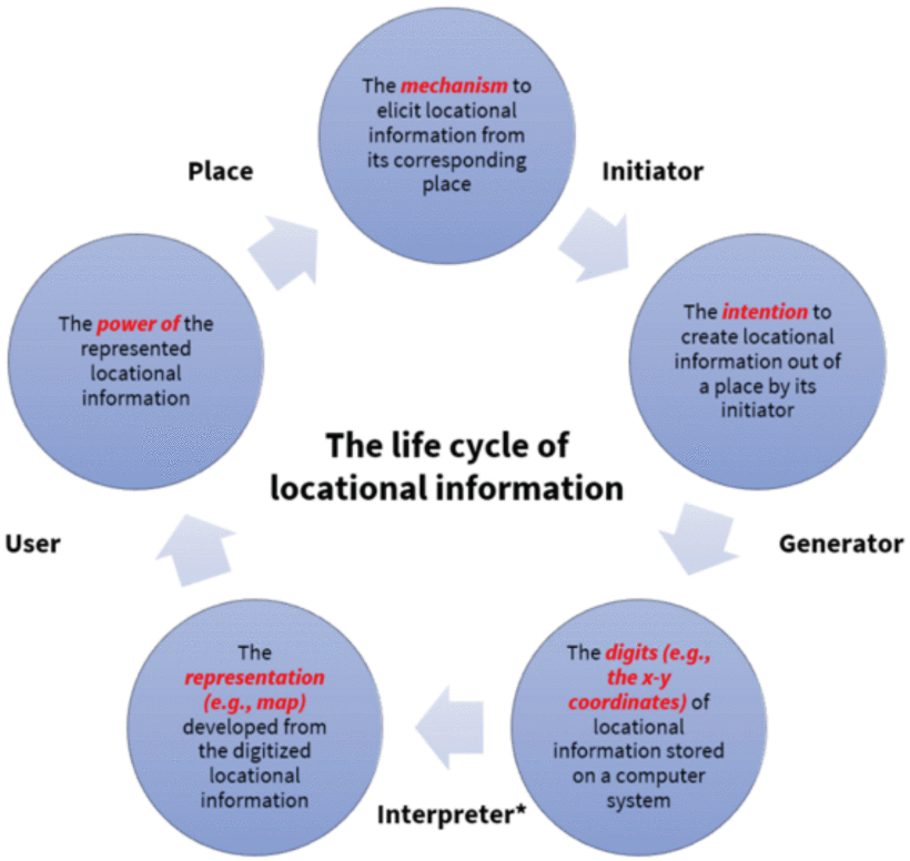
This lifecycle implies that locational information is not just in the form of digits or representations (e.g., a map); it can also maintain itself as an intention, a mechanism, or power. In this regard, locational information does not exist in one form; it varies freely across the five primary forms, and the momentary form depends on how interaction occurs with locational information; locational information is a mirror of its involved data actor and the Place. It is essential to pay extra attention to how different marginalized communities are mediated by locational information, but we also should not assume that there is a uniform mediation of locational information. Also, in the lifecycle, different involved members of the public have different interests. For example, the Place owner has the right to allow or forbid people to generate locational information from the owned Place.
As shown in Fig. 1, the five elements of the lifecycle are defined as follows:
Place: where a data actor initiates the locational data generation. This Place can be owned by the government, the private sector, community, or individuals. Sometimes, an Initiator may spoof his or her location via a virtual private network (VPN).
Initiator: a human or non-human actor whose position was captured by the Generator.
Generator: usually a computer system (a non-human actor) that can produce locational information containing the geographic coordinates (e.g., latitude and longitude). A Generator can be a GPS logger, location-based app, or geocoding service.
Interpreter: a human (e.g., researcher, government agent, GIS developer) or non-human actor (e.g., Esri COVID-19 dashboard; or SafeGraph, which synthesizes mobile phone pings and redistributes them for profit) who interprets or redistributes locational information into a new format, such as a database, a map, or a geovisualization.
User: a human or non-human actor (e.g., a delivery bot that can navigate itself to the destination based on a database of locational information) who utilizes the locational information.
Examples of forbidding Place visitation include setting no-trespass areas and no-fly zones. If the Place owner allows others to collect the locational information of the Place, the Place owner should receive incentives; the Initiator has freedom of speech (to generate accurate location and to spoof location); the ownership of the locational information; the right to protect privacy or not to protect it; the right to be forgotten; the right to trace the distributed locational information on other platforms; the right to have the final say in whether the information should be kept or deleted; and the right to make a profit from exchanging or selling locational information. The User has the right to know the truth: in particular, the user has the right to access the context and the trustworthiness of locational information so that no harm will be caused to other data actors.
Example 1a, Amazon Warehouse Workers: Amazon regularly tracks its warehouse workers through various methods to boost production efficiency. The effort to optimize efficiency comes at the expense of worker’s rights and has fueled unionization efforts. Location technology boosts the corporate entity’s production potential at the expense of individual worker rights. https://www.washingtonpost.com/technology/2021/12/02/amazon-workplace-monitoring-unions/.
Example 1b, Prim: Apart from the cultural biases discussed above, other biases emerge from other social factors, such as for individuals who are members of small social groups, as their social roles and social status can be more visible. A good example is Amazon’s algorithm, which decided to exclude certain geographical areas from its same-day Prime delivery system based on whether a particular zip code has sufficient Prime members, the availability of a nearby warehouse, and eligible workers willing to deliver to those areas. Although profit motivations drove it, this resulted in the exclusion of under-resourced economic and social areas—predominantly African-American neighborhoods in the U.S. context, as reported by Bloomberg and numerous other news outlets in 2016. https://www.bloomberg.com/graphics/2016-amazon-same-day/.
Example 2, Microsoft’s “Avoid Ghetto” App: In 2012, Microsoft released an app that allowed users to avoid high crime areas when traveling by foot. Creating safe passage is a helpful feature for pedestrians; however, the impact on communities and the methods used to generate the recommendations have real-world implications for the avoided communities. Depriving communities of revenue may reinforce the economic conditions that led to the classification in the first place. This assumes that the algorithm is accurate and unbiased—a problem that may create the conditions it claims to avoid. https://grist.org/cities/microsofts-avoid-ghetto-app-is-kind-of-gross/.
Example 3, Period Tracking Apps Post-Roe v. Wade: In the aftermath of the recent Supreme Court decision to overturn Roe v. Wade, there has been a renewed emphasis on the risks of period tracking apps. These apps contain data the authorities can access to support criminal investigations and geolocate individuals. Broader risks are posed by geolocation technologies embedded in all mobile phones, which support the collection and storage of locational data by cloud and cellular providers. https://www.huffpost.com/entry/delete-period-trackers-apps-abortion_l_62b5ebf8e4b0cdccbe6b1a06.
Example 4, Transborder Immigrant Tool: The Transborder Immigrant Tool is a mobile phone application developed in 2007 by Electronic Disturbance Theater (EDT) 2.0/b.a.n.g. Lab, which would use GPS to lead immigrants crossing the U.S./Mexico border to caches of water hidden in the desert while also delivering poetry to them to ease their mental health during the journey. By 2010, the project became so controversial that it was investigated by three Republican Congressmen, the Federal Bureau of Investigation (FBI) Office of Cybercrimes, and the University of California, San Diego, where one of the artists, Ricardo Dominguez, was an associate professor in the Department of Visual Arts. https://anthology.rhizome.org/transborder-immigrant-tool.
Example 5, Combined Homelessness And Information Network (CHAIN) and the U.K: Home Office. In 2015, the Office of the Mayor of London funded a database—the Combined Homelessness And Information Network (CHAIN)—to be administered by St. Mungos, a large homeless charity, and granted access to the Greater London Authority. Charity outreach workers established a listing for each homeless person, with their name, gender, age, special needs, unhoused history, and, importantly, their regular location and nationality.
In May 2015, the Greater London Authority gave permission to the U.K. Home Office to access the CHAIN database without consultation with St. Mungos. The U.K. Home Office used those data to go to the regular locations of non-U.K. nationals and either voluntarily or forcibly deport those individuals. “A leading homelessness charity passed key information about migrant rough sleepers to Home Office enforcement teams and may well have done so without their consent” [73]. “The app [is] analogous ‘to border guards knocking on every door in the U.K. and forcing E.U. nationals to show documentation.”’ [74], [75].
Example 6, Location Trackers used for Stalking: Products and features that integrate and rely on locational information are used to monitor, harass, and control people who are the targets of gender-based violence, including stalking, domestic violence, and human trafficking. While there are some purpose-built stalking tools, most of the tools used for stalking are readily available: standard technologies like smartphones, small location trackers for keys or wallets, apps, social media, and cloud-based accounts (e.g., features to find a lost phone). Due to the variety of technologies that include locational information, it can be challenging for survivors of gender-based violence to determine how they are being tracked and how best to respond. https://www.theguardian.com/technology/2022/jan/20/apple-airtags-stalking-complaints-technology.
Example 7, Standing Rock in the Stand with #StandingRock cyberprotest: Facebook users from over the world falsified (spoofed) their online locations (check-ins) to support tribes at Standing Rock to preserve their territories that would be damaged by a crude oil pipeline. https://www.theguardian.com/us-news/2016/oct/31/north-dakota-access-pipeline-protest-mass-facebookcheck-in.
Example 8, Food Delivery: GIS engineers at big tech companies (e.g., Yelp, Uber, DoorDash) added race to the locational information of Black-owned restaurants with the intent of supporting Black communities after the murder of George Floyd. Although this support from GIS engineers was motivated by goodwill, studies show this campaign did not help the Black community in the long run and incurred racist comment [76]. Tracking and racializing location data in the course of business transactions can have unintended effects and produce harm on vulnerable communities even when it is intended to help them. https://www.tandfonline.com/doi/full/10.1080/24694452.2022.2095971.
Example 9, Uber and Lyft Pricing: Machine learning (ML) can be used to set differential pricing for the same product considering the affluence of a suburb, including whether residents live in a particular suburb dominated by prime customers who are primarily white [77]. For instance, Uber and Lyft have been receiving criticism for racial bias as they were using ML algorithms to determine fares based on the suburb status of riders. Using transport and census data in Chicago with more than 100 million trips between November 2018 and December 2019, scholars at George Washington University found that Uber and Lyft charged a premium price where pick-up or destination suburbs were predominantly populated by ethnic minorities compared to white residents [74]. https://www.usatoday.com/story/tech/2020/07/22/uber-lyft-algorithms-discriminate-charge-more-nonwhite-areas/5481950002/.
Example 10, Strava and Military Tracking: In 2018, Australian university student Nathan Ruser discovered a security threat through the fitness app Strava. The app allows a user to access a global heatmap to show a network of athletes. However, the map showed very clearly sensitive information, including military personnel’s locations and running routines at bases in the Middle East and other conflict zones, posing a global security threat. https://www.katinamichael.com/media/2018/2/2/the-new-visibility-open-intelligence-location-datavoluntary-crowdsourcing.
SECTION VII.
Recommendations
Here we offer 20 recommendations to the geospatial technology and locational data communities to consider when engaging in any aspect of the lifecycle of location technology projects. As a group of researchers and professionals, we have grappled with these issues in our practice. This set of recommendations is based on our collective experience, which we recognize as limited. As such, we see these recommendations as the starting point for a conversation, and we invite each reader to add their voice and experience to what we hope will be a growing list of guidance for our community.
Recommendation 1. Explore Community Collaboration: Working with communities that have not historically been included in GIS projects, discuss new models for collaboration. Avoid parachuting into short-term, one-off projects. Instead, build relationships that last across projects and support the capacity of communities to participate and even take leadership on GIS issues in the future. When initiating collaborations with communities, inquire into the solutions or approaches they have already developed and may have used for years (or centuries). Do not assume that thinking “geographical” is entirely new to these communities.
Recommendation 2. Explore Corporate Collaboration: Engage with big tech companies producing locational information (e.g., Google Maps, Apple Maps, Foursquare, Yelp). Through such collaborations, on the one hand we learn how these software developers design the locational product and whether locational information has been processed appropriately. On the other hand, researchers work as a bridge to connect tech companies with public users.
Recommendation 3. Publish Findings and Disseminate: Broadly, researchers should aim to make research results digestible to as many people as possible. When calling for papers, think about asking paper authors to provide a half-page summary written in a way that almost everyone comprehends. Note that reaching out to historically marginalized communities may subject your research goals to their needs, for example in collecting different types of data, using specific platforms to gather information, or publishing in the popular press.
Recommendation 4. Diversify Your Network: It matters who is in the room. Be aware of the teams you build and the panels you agree to be on. Is the panel or attendee list sufficiently diverse? If not, make recommendations for how the panel might be diversified. Avoid tokenizing and shallow diversity. Allow people to bring a colleague of their choice to build diverse networks and provide support for participation.
Recommendation 5. Marginalized Communities are not Monolithic: Communities vary, and care should be taken to avoid transposing views from one group onto another. Embracing this concept requires identifying communities that should be engaged, considering when each community should be engaged, and developing an overall strategy for respectful interaction.
Recommendation 6. Be Good Allies to Historically Marginalized Communities: Listen! Sometimes, outreach approaches ask people and communities to share their place-based stories and lived experiences of locational information. These requests may place an emotional or psychological burden on people who have already experienced enormous difficulties. So, it is important to listen when those stories arise and be clear about how that sharing will shape future decisions and projects. In addition, a good ally should consciously avoid undermining the credibility or validity of the story.
Recommendation 7. Minimize Bias in Data: Big geospatial data can be used for many unique applications because they provide measurement over large areas. However, these data are often biased in favor of people who already have technology access. For example, the proliferation of data generated by mobile apps and cell phones is biased toward people with phones and data plans. Children of a certain age, the elderly, and unhoused people are examples of groups that are not captured in cell phone-based datasets. It is important to evaluate who is included and excluded in any data sample and interrogate how that might impact research results and findings.
In some cases, the bias can be acknowledged in the communication of the work, but more often, it is critical to take the time to recognize and reveal bias in data and correct for bias if possible. GeoAI, which can be used to computationally de-bias through training on known data, provides a helpful approach to accounting for bias in some cases but can be a source of geographical biases as well. In other cases, the bias is just too significant, and the harm of doing the research is too great because the knowledge generated may reinforce the perspectives of people with power at the expense of people who lack access. It is always important to consider how the results could amplify pre-existing biases or widen access and social equity gaps.
Recommendation 8. Encourage Interpretation from Different Perspectives: Encourage different ways of interpreting the experimental results based on the same dataset. Whenever possible, include interpreters from different groups to ensure that harm is reduced as much as possible. Be particularly considerate about generalizing (potential) causal relationships across different groups of people.
Recommendation 9. Model Limitations in Models: Acknowledge the limitation of inference capabilities and functionalities for under-represented groups. Like the section on” “Code and Availability” “required by most academic journals, perhaps we should encourage researchers to add a section elaborating on the Diversity, Equity, and Inclusion (DEI) of their work (not about how their team is diversely composed, but more on how their work follows DEI principles and what limitations they already identify in terms of DEI, and how they protect geoprivacy of their subjects (humans and animals)).
Recommendation 10. Evaluate Research Questions: We need to include geographic communities even before we conduct research, collect locational data, or build our apps. This requires that communities are included in the questions we develop. For example, a common goal in active transportation is to increase access to bicycling infrastructure for low-income people and communities of color. In these cases, access tends to be defined based on proximity and may be articulated as aiming to increase the percentage of people that live within 0.5 km of a bike lane. Standard proximity-based measures of accessibility are idealized and assume that being near something means you can access it. In reality, access is more complex. Realized access is informed by various factors that condition the relationship between proximity and access. Racialized encounters with police-based traffic enforcement may influence bicycling accessibility, the ability to purchase a bike, or the availability of secure parking. Realized accessibility must include connectivity; living near a bike lane is only beneficial if it connects to destinations that matter to the cyclist.
Recommendation 11. Include Ethics in Peer Review: Given this history of geography and mapping, like many other fields of research and practices, we are accountable for historical harm. At a minimum, every review should include a paragraph on ethics and equity and, ideally, should weave these considerations throughout. Along with considering if the research violates the assumptions of a regression model, we could consider if the research is increasing or decreasing social justice. If we approach our work with humility, we can find a way to be open to critique and work toward increasing the standard of ethics and our support for equity. If journals and granting agencies asked every reviewer to consider issues of ethics and equity, how would our practices shift? What could we learn about how we are doing our work? We also should suggest that our journals and granting agencies add these statements and our supervisors reward ethical behavior, especially as increasing diversity can slow research.
Recommendation 12. Be Humble: Always be aware of intersectionality within and among marginalized communities, how multiple structures of inequity overlap to impact communities and advocate for a multicultural environment when locational information is used. Acknowledge the limits of one’s knowledge and experience and one’s positionality. Balance an openness to listen to the community with efforts to educate about their history, practices, and values. This approach will help avoid burdening that community with unnecessary emotional labor. Listening should be accompanied by doing what we can to address issues of importance to communities.
Recommendation 13. Fund Research that Engages Communities: For research to be more inclusive, it must engage and empower underserved communities beyond its traditional user base. This approach requires the provisioning of financial, technological, and material resources that support the development of more community-driven, community-designed research. This approach does not do away with basic, curiosity-driven research but rather aims to make space for research that responds to communities’ needs, geospatial and otherwise. Whereas a great deal of geospatial research focuses on outreach and dissemination, funding agencies could support exploratory meetings that go to a community to find out what they might be interested in doing with geotechnology and then pursue research that helps realize their objectives. An evaluation schema also should be implemented to judge if funded or to-be-funded research has geoethical issues. This could include whether the locational data are collected appropriately, whether the findings should be extendable to other communities beyond those where data were collected, and whether the research involved diverse communities.
Recommendation 14. Diversify Pathways: Research and practice in locational data often draw on the powerful skills of GIScience. Diversifying paths to enter the field of GIScience can provide a mechanism for diversifying the people involved. Like all STEM fields, traditional GIScience training stacks knowledge on prerequisite understanding and requires a linear pathway through education. The more mechanisms we can create for entering the field, the more opportunities we create for students to find their way into and to join GIScience. Online learning, boot camps, summer schools, and degrees that vary in depth and application all have a role to play. For example, at Arizona State University, when the School of Geographical Sciences and Urban Planning offered online geography degrees, the number of Black majors tripled, highlighting how new pathways can support diversity. The systems we use for training are effective for some people, but it is time to add to them and be creative about where we value GIScience training.
Recommendation 15. Commit to Deeper Stakeholder Engagement: Advancing geospatial technologies and locational data handling as both a theoretical and technical practice requires engaging all stakeholders continuously. Such engagement can be pursued virtually and in person, from venues ranging from community forums to international conferences. Participation should not be limited to an event but should begin with planning and continue through interpretation, implementation, communication, and evaluation. Financial resources are necessary to ensure that representatives of underserved communities can afford to engage, both in terms of time and money. We also must be mindful that unequal power relations are not automatically addressed through engagement methods alone.
Recommendation 16 (Support Geospatial Organizations Led by Underrepresented Groups): A variety of organizations run or support groups underserved in the fields of geotechnology and locational data. NorthStar of GIS, African Women in GIS, and Black Geographers are just some examples of organizations that merit support. For example, NorthStar of GIS offers anti-racism training and brings a GIS lens to its offerings. Following these organizations and diverse scholars and professionals on social media is an easy way to hear more about the perspectives of underrepresented members of the GIScience community without asking individuals to do more work.
Recommendations 17. Increase Accessibility of Research and Data: There are many barriers to entering the fields of geotechnology and locational data. Like many STEM fields, GIS is technical and requires specialized knowledge, leading to exclusion. There are a lot of ways to make research more accessible. Open science and sharing data and code is a first step in increasing accessibility. Deploying methods in easy-to-use software can also improve the accessibility of data and methods. However, this may restrict use to those who can afford the software unless it is also open software. Researchers should consider ways to share results with a broader audience, including blogs or op-eds that showcase findings, and how geospatial data and methods are advancing scientific understanding. There are pros and cons to the mechanisms used to make research accessible, but various approaches will help to ensure broadened participation.
Recommendation 18. Hold Spatial Fundamentals Close to the Heart: Spatial data analysis is not for the faint of heart. There is a lot to keep track of when conducting analyses and making inferences: the modifiable areal unit problem, ecological fallacy, spatial heterogeneity, and the relationship between spatial pattern and process. As geospatial data and the use of analytics proliferate, so too does the potential for misuse or error. Critical issues like Opensha’s modifiable areal unit problem (MAUP), the ecological fallacy, and the uncertain geographic context problem (UGCoP) will fundamentally influence the results and interpretation of the analysis [78], [79]. Different findings can be generated from the same phenomena mapped in different ways, which means that we should carefully consider how we represent data and be clear about the limitations. Spatial heterogeneity, or variation across geography, means that relationships observed in one location could be different at another location. As a result, caution is required when generalizing across space. Another challenge is that spatial patterns and processes have a one-to-many relationship. Many different spatial processes can lead to a particular spatial pattern, and as a result, it can be challenging to tease out causality when analyzing patterns. Fortunately, there is plenty of good literature to help minimize inferential error when working with geospatial data [80].
Recommendation 19. Ethical Implications of Research: Researchers should consider the ethical implications of their research and, if the harm outweighs the benefits, whether the research should be pursued in the first place. People in fields that rely on geospatial methods should foster open debates about whether research and applications should refrain from specific uses. For instance, there is an ongoing debate in computer vision and AI as to whether facial recognition research brings about more harm than benefits. Some researchers take the view that it is acceptable for the research to proceed so long as informed consent is sought from participants (who, in the case of facial recognition research, agreed to have their photographs taken or repurposed). However, others assert that such research is inherently unethical because of the potential for facial recognition technology to be used to harm populations, especially marginalized ones. While locational data do not invite as much controversy as facial data, this may be because the data are already ubiquitous. However, preexisting ubiquity does not mean that we should cease debate over the ethics of using locational data in the first place, along with its myriad applications. GIScience should face these issues head-on and be at the forefront of predicting ethical debates and controversies, both in and beyond research, rather than reacting to such issues only after they arise [81].
Recommendation 20. Build GIS Allyship: Within the field of GIScience, GIS Allyship is a mechanism used by researchers to become better collaborators, accomplices, and even co-conspirators to underserved populations and work together to fight against the spatial and social injustice and inequality caused by the use of locational information.
A. Conclusion
The participants at the Summit included researchers and professionals who grapple with issues of geospatial technology and locational data in practice. Examples and recommendations are offered here in the hope that they acknowledge our past and will help lead to a better future. This report is based on our collective experience, which we recognize to be limited. As such, we see these recommendations as the start of an ongoing conversation. We invite each reader to add their voice and experience to what we hope will be a growing list of guidance for our community.
SECTION VIII.
Afterword
This paper comes from the collaborative contributions of participants at our Summit who were brought together by a common concern for the uneven ethical, legal, and social implications of locational information. These concerns need wider recognition by many stakeholders because of the increased use of locational information across applications and disciplines.
We are committed to incorporating the recommendations covered in this paper in our work, and actively encourage our colleagues to do so. We will continue to improve our understanding and practice in this area. This paper incorporates a range of opinions and recommendations; we refer the reader to each section for the full discussion. We will seek to share these recommendations with heterogeneous audiences, domestically, internationally and with non-traditional and indirect GIS stakeholders, to enhance the dialogue over location data and the public interest, the integration of location ethics into curricula, the development of an enforceable regulatory regime concerning location technologies, and to increase collaboration between academics, policymakers, and the public and private sectors on the use of locational information. We will respectfully listen and respond to critiques and contributions from non-traditional partners and historically marginalized communities. We will also reflect on how the Summit that led to this paper had weaknesses, and we hope the measures offered here will improve future summits and projects.
Our Summit was intended to be diverse in perspectives and disciplines, and although we were able to gather social scientists, computer scientists, humanists, and legal scholars and professionals, this gathering still did not fully represent the perspectives and stakeholders needed to make any final statement or directive on this evolving issue. This paper serves as a set of recommendations for continued and collaborative work in the coming years targeting different audiences, and to build dialogue with additional perspectives and stakeholders. We hope that anyone reading this paper will take an interest in acting on or adding to these recommendations, including the urge to take leadership in building dialogue or in addressing any of the gaps identified within their community of practice.
A. Participants in the June 2022 GeoEthics Summit
Organizing Committee on Locational Information and the Public Interest
Michael Goodchild (University of California, Santa Barbara)
Gary Langham (Executive Director, American Association of Geographers)
Richard Appelbaum (University of California, Santa Barbara)
Jeremy Crampton (University of Newcastle-upon-Tyne, U.K.)
William Herbert (Hunter College, City University of New York)
Krzysztof Janowicz (University of California, Santa Barbara, University of Vienna, Austria)
Mei-Po Kwan (Chinese University of Hong Kong)
Katina Michael (Arizona State University)
Staff
Karen Doehner (University of California, Santa Barbara)
Coline Dony (Senior Geography Researcher, American Association of Geographers)
Julaiti Nilupaer (Research Assistant, American Association of Geographers)
Lisa Schamess (Director of Communications, American Association of Geographers)
Summit Participants
The authors thank the following individuals (who are also listed as co-authors) for their diverse expertise, perspectives, and contribution to the efforts:
Luis F. Alvarez León (Department of Geography, Dartmouth College), spatial thinking, critical GIS, economic, and digital geographies
Mia Bennett (Department of Geography, University of Washington), critical remote sensing, Polar geographies, geopolitics
Daniel G. Cole (IT Office, National Museum of Natural History Smithsonian Institution), GIS, cartography
Kitty Currier (Center for Spatial Studies, Department of Geography, University of California, Santa Barbara), participatory mapping, environmental planning
Victoria Fast (Department of Geography, University of Calgary), GIScience, human geography, urban studies, accessibility mapping
Jeffrey Hirsch (University of North Carolina, School of Law), labor and employment law
Markus Kattenbeck (Research Division Geoinformation, TU Wien), spatial human-computer interaction, GIScience, behavioral geography
Peter Kedron (School of Geographical Science and Urban Planning, Spatial Analysis Research Center, Arizona State University), replicability of geographic research, practices of geographic researchers, spatial analysis
Joseph Kerski (Environmental Systems Research Institute, University of Denver), geotechnologies, spatial thinking, geography education
Zilong Liu (STKO Lab, Department of Geography, Center for Spatial Studies, University of California, Santa Barbara), knowledge graphs, GeoAI, geospatial semantics
Trisalyn Nelson (Department of Geography, University of California, Santa Barbara), big data analytics, healthy geography, transportation
Toby Shulruff (Public Interest Technology, School for the Future of Innovation in Society, College of Global Futures, Arizona State University), technology and gender-based violence
Renée E. Sieber (Department of Geography, Bieler School of Environment, School of Computer Science, McGill University), geospatial technologies, public participation, GeoAI
John A. Wertman (Environmental Systems Research Institute), public policy, government relations, geographic data
Clancy Wilmott (Department of Geography, Berkeley Center for New Media, University of California, Berkeley), spatial representation, digital geographies, settler-colonial spaces
May Yuan (Geospatial Information Sciences, The University of Texas at Dallas), geographic representations, computational methods
Bo Zhao (Department of Geography, University of Washington, Seattle), humanistic GIS, geospatial misinformation, and digital geographies
Rui Zhu (Center for Spatial Studies, University of California, Santa Barbara. School of Geographical Sciences, University of Bristol, U.K.), spatial statistics, geospatial semantics, knowledge graphs, GeoAI
Note: Each participant was also prompted to serve an additional role to support the development of the outcomes of the Summit, such as a panelist, a moderator, or a note taker.
ACKNOWLEDGMENT
This paper was created collaboratively by the members of the Organizing Committee and drew insight from the participation of 18 invited participants at a Summit held in June 2022 in Santa Barbara. The full list of participants is available at the end of this paper. In addition to this paper, AAG and the Organizing Committee have prepared a Quick-Start Guide for Educators https://www.aag.org/locational-information-quick-start-guide/.
References
1. A. J. Blatt, “Ethics and privacy issues in the use of GIS,” J. Map Geogr. Libraries, vol. 8, no. 1, pp. 80–84, 2012.
2. P. M. Gómez, A. R. Santiago, G. G. Seco, R. Casanova, D. MacKenzie, and C. Tucker, “Ethics in the use of geospatial information in the Americas,” Technol. Soc., vol. 69, May 2022, Art. no. 101964.
3. M. H. Maras, M. D. Miranda, and A. S. Wandt, “The use of COVID-19 contact tracing app data as evidence of a crime,” Sci. Justice, vol. 63 no. 2, pp. 158–163, Mar. 2023, doi: 10.1016/j.scijus.2022.12.008. [Online]. Available: https://www.ncbi.nlm.nih.gov/pmc/articles/PMC9805950/
4. N. Morris, A. Bunn ( AustLII, Ultimo NSW, Australia ). When Trust Fails Purpose: Legislative Lessons from Police Access to the Safeway COVID-19 Contact Tracing Data. 2023. [Online]. Available: https://www8.austlii.edu.au/au/journals/UWALawRw/2023/16.pdf
5. G. Burke, J. Federman, H. Wu, K. Pathi, and R. McGuire ( AP News, New York, NY, USA ). Police Seize on COVID-19 Tech to Expand Global Surveillance. Dec. 2022. [Online]. Available: https://apnews.com/article/technology-police-government-surveillancecovid-19-3f3f348d176bc7152a8cb2dbab2e4cc4
6. J. E. Dobson and W. A. Herbert, “Geoprivacy, Convenience, and the Pursuit of Anonymity in Digital Cities,” in Urban Informatics (The Urban Book Series), W. Shi, M. F. Goodchild, M. Batty, M. P. Kwan, and A. Zhang, Eds. Singapore : Springer, 2021. [Online]. Available: https://doi.org/10.1007/978-981-15-8983-6_32
7. R. Kitchin, “Making sense of smart cities: Addressing present shortcomings,” Cambridge J. Reg., Econ. Soc., vol. 8, no. 1, pp. 131–136, Mar. 2015. [Online]. Available: https://doi.org/10.1093/cjres/rsu027
8. L. Perusco and K. Michael, “Control, trust, privacy, and security: Evaluating location-based services,” IEEE Technol. Soc. Mag., vol. 26, no. 1, pp. 4–16, Mar. 2007, doi: 10.1109/MTAS.2007.335564.
9. K. Michael and M. G. Michael, “The social and behavioural implications of location-based services,” J. Locat. Based Services, vol. 5, nos. 3–4, pp. 121–137, 2011. doi: 10.1080/17489725.2011.642820.
10. L. Perusco, L. K. Michael, and M. G. Michael, “Location-based services and the privacy-security dichotomy,” in Proc. 3rd Int. Conf. Mobile Comput. Ubiquitous Netw., London, U.K., Oct. 2006, pp. 91–98.
11. R. Abhayaratna, E. Daemen, K. Janowicz, E. Parsons, R. Smith, and F. Verschoor. “The responsible use of spatial data.,” W3C. May 2021. [Online]. Available: https://www.w3.org/TR/responsible-use-spatial/
12. K. Todd, J. G. Eastwood, P. Fotheringham, J. A. Salinas-Perez, and L. Salvador-Carulla, “Using geospatial analysis to inform development of a place-based integrated care initiative: The healthy homes and neighbourhoods experience,” Int. J. Integr. Care., vol. 21, no. 2, p. 23, Jun. 2021, doi: 10.5334/ijic.5430. [Online]. Available: https://www.ncbi.nlm.nih.gov/pmc/articles/PMC8231470/
13. K. Cooke. “Using GIS to map the way to housing equity.,” ArcUser. 2023. [Online]. Available: https://www.esri.com/about/newsroom/arcuser/using-gis-to-map-theway-to-housing-equity/
14. S. Semborski, J. G. Winn, H. Rhoades, L. Petry, and B. F. Henwood, “The application of GIS in homelessness research and service delivery: A qualitative systematic review,” Health Place, vol. 75, May 2022, Art. no. 102776. doi: 10.1016/j.healthplace.2022.102776. [Online]. Available: https://www.ncbi.nlm.nih.gov/pmc/articles/PMC9188995/
15. R. Abbas, K. Michael, and M. G. Michael, “The regulatory considerations and ethical dilemmas of Location-Based Services (LBS): A literature review,” Inf. Technol. People, vol. 27, no. 1, pp. 2–20, 2014. [Online]. Available: https://doi.org/10.1108/ITP-12-2012-0156
16. P. A. Longley, M. F. Goodchild, D. J. Maguire, and D. W. Rhind, Geographical Information Science and Systems, 4th ed. Hoboken, NJ, USA : Wiley, 2015.
17. R. Abbas, K. Michael, and M. G. Michael, “Using a social-ethical framework to evaluate location-based services in an Internet of Things world,” Int. Rev. Inf. Ethics, vol. 22, pp. 42–73, Dec. 2014. [Online]. Available: https://doi.org/10.29173/irie118
18. K. Janowicz, R. Sieber, and J. Crampton, “GeoAI, counter-AI, and human geography: A conversation,” Dialogues Human Geogr., vol. 12, no. 3, pp. 446–458, 2022. [Online]. Available: https://journals.sagepub.com/doi/full/10.1177/20438206221132510
19. K. Michael, R. Abbas, and J. Pitt ( AAG GeoEthics, Washington, DC, USA ). Emerging Location-Based Services and Technologies, Geosurveillance and Social Justice Issues, Aug. 2021. [Online]. Available: https://aag-geoethics-series.secureplatform.com/a/solicitations/10/sessiongallery/201
20. J. Wang, J. Kim, and M.-P. Kwan, “An exploratory assessment of the effectiveness of geomasking methods on privacy protection and analytical accuracy for individual-level geospatial data,” Cartogr. Geogr. Inf. Sci., vol. 49, no. 5, pp. 385–406, 2022.
21. D. Richardson, M.-P. Kwan, G. Alter, and J. E. McKendry, “Replication of scientific research: Addressing geoprivacy, confidentiality, and data sharing challenges in geospatial research,” Ann. GIS, vol. 21, no. 2, pp. 101–110, 2015.
22. M.-P. Kwan, I. Casas, and B. C. Schmitz, “Protection of geoprivacy and accuracy of spatial information: How effective are geographical masks? ” Cartographica, vol. 39, no. 2, pp. 15–28, 2004.
23. J. Kim and M.-P. Kwan, “Travel time errors caused by geomasking might be different between transportation modes and types of urban area,” Trans. GIS, vol. 25, no. 4, pp. 1910–1926, 2021. [Online]. Available: https://onlinelibrary.wiley.com/doi/10.1111/tgis.12751
24. G. McKenzie, C. Keßler, and C. Andris, “Geospatial privacy and security,” J. Spatial Inf. Sci., vol. 2019, no. 19, pp. 53–55, 2019. [Online]. Available: http://doi.org/10.5311/JOSIS.2019.19.608
25. J. Kim and M.-P. Kwan, “An examination of people’s privacy concerns, perceptions of social benefits, and acceptance of COVID-19 mitigation measures that harness location information: A comparative study of the U.S. and South Korea,” ISPRS Int. J. Geo-Inf., vol. 10, no. 1, p. 25, 2021. [Online]. Available: https://doi.org/10.3390/ijgi10010025
26. M-P Kwan, J. Huang, and Z. Kan, “People’s political views, perceived social norms, and individualism shape their privacy concerns for and acceptance of pandemic control measures that use individual-level georeferenced data,” Int. J.Health Geograph., vol. 22, p. 35, Dec. 2023. [Online]. Available: https://doi.org/10.1186/s12942-023-00354-3
27. R. Abbas, K. Michael, and M. G. Michael, “What can people do with your spatial data?: Socio-ethical scenarios,” in Managing Security Issues and the Hidden Dangers of Wearable Technologies, A. Marrington, D. Kerr, and J. Gammack, Eds., Hershey, PA, USA : Inf. Sci. Ref., 2017, pp. 206–237.
28. K. Michael and R. Clarke, “Location and tracking of mobile devices: Überveillance stalks the streets,” Comput. Law Secur. Rev., vol. 29, no. 3, pp. 216–228, 2013.
29. J. Pickles, Eds., Ground Truth: The Social Implications of Geographic Information Systems. New York, NY, USA : Guilford Press, 1995.
30. G. McKenzie, H. Zhang, and S. Gambs, “Privacy and ethics in GeoAI,” in Handbook of Geospatial Artificial Intelligence, S. Gao, Y. Hu, and W. Li, Eds., New York, NY, USA : CRC Press, 2023.
31. K. Janowicz, “Philosophical foundations of GeoAI: Exploring sustainability, diversity, and bias in GeoAI and spatial data science,” in Handbook of Geospatial Artificial Intelligence. Boca Raton, FL, USA : CRC Press, 2023, pp. 26–42.
32. J. E. Thatcher and C. M. Dalton, Data Power: Radical Geographies of Control and Resistance, E. Jim, Ed. London, U.K. : Pluto Press, 2022.
33. O. Söderstrom and A. Datta, Eds., Data Power in Action: Urban Data Politics in Times of Crisis Bristol, U.K. : Bristol Univ. Press 2024.
34. L. Ash, R. Kitchin, and A. Leszczynski, “Digital turn, digital geographies? ” Prog. Human Geogr., vol. 42, no. 1, pp. 25–43, 2018. [Online]. Available: https://doi.org/10.1177/0309132516664800
35. J. Ash, R. Kitchin, and A. Leszczynski, Eds., Digital Geographies. Losa Angeles, CA, USA : Sage, 2019.
36. J. W. Crampton, “Beyond the geotag: Situating ‘big data’ and leveraging the potential of the geoweb,” Cartograph. Geograph. Sci., vol. 40, no. 2, pp. 130–139, 2013. [Online]. Available: https://doi.org/10.1080/15230406.2013.777137
37. R. Abbas, “Location-Based Services (LBS) regulation in Australia: A socio-technical approach,” Ph.D. thesis, Univ. Wollongong, Wollongong, NSW, Australia, 2012. [Online]. Available: https://ro.uow.edu.au/theses/3666
38. K. Michael and H. Tootell, “Introducing location-based services into information technology curriculum: Reflections on practice,” in Proc. Int. Conf. Mobile Business (ICMB), Sydney, NSW, Australia, 2005, pp. 220–226, doi: 10.1109/ICMB.2005.52.
39. J. Crampton, “GIS and critical ethics,” in The Geographic Information Science & Technology Body of Knowledge, (2nd Quarter 2018 Edition), J. P. Wilson Ed., Chesapeake, VA, USA : Univ. Consort. Geograph. Inf. Sci., 2018. [Online]. Available: https://doi.org/10.22224/gistbok/2018.2.8
40. b. hooks, Teaching to Transgress: Education as the Practice of Freedom, 1st ed. New York, NY, USA : Routledge, 1994.
41. L. A. Paul, Transformative Experience. Oxford, U.K. : Oxford Acad., 2014. [Online]. Available: https://doi.org/10.1093/acprof:oso/9780198717959.001.0001
42. J. Crampton ( Am. Assoc. Geograph., Washington, DC, USA ). Quick Start Guide to Integrate the Ethics of Locational Information into Your College and University Courses and Programs. 2022. [Online]. Available: https://www.aag.org/locational-information-quick-start-guide/
43. C. Fiesler ( Medium, San Francisco, CA, USA ). Tech Ethics Curricula: A Collection of Syllabi. Jul. 2018. [Online]. Available: https://cfiesler.medium.com/tech-ethics-curricula-a-collection-of-syllabi-3eedfb76be18
44. B. Arnold ( Zenodo, Munich Germany ). The Turing Way: A Handbook for Reproducible Data Science. 2019. [Online]. Available: http://doi.org/10.5281/zenodo.3233986
45. W. A. Herbert, “Workplace electronic privacy protections abroad: The whole wide world is watching,” Univ. Florida J. Law sPublic Policy, vol. 19, no. 3, pp. 379–420, 2008. [Online]. Available: https://scholarship.law.ufl.edu/jlpp/vol19/iss3/2
46. R. P. Appelbaum, “From public regulation to private enforcement: How CSR became managerial orthodoxy,” in Achieving Workers’ Rights in the Global Economy, R. P. Appelbaum and N. Lichtenstein, Eds. Ithaca, NY, USA : Cornell Univ. Press. 2006.
47. R. P. Appelbaum and N. Lichtenstein, “Introduction: Achieving Workers’ Rights in the Global Economy,” in Achieving Workers’ Rights in the Global Economy, R. P. Appelbaum and N. Lichtenstein, Eds. Ithaca, NY, USA : Cornell Univ. Press. 2006.
48. “EU artificial intelligence act.,” Accessed: Aug. 1, 2024. [Online]. Available: https://artificialintelligenceact.eu/
49. M. Bovens, “The concept of public accountability,” in The Oxford Handbook of Public Management, vol. 182, E. Ferlie, L. E. Lynn Jr. and C. Pollitt, Eds. Oxford, U.K. : Oxford Univ. Press, 2005.
50. S. Costanza-Chock, I. D. Raji, and J. Buolamwini, “Who audits the auditors? Recommendations from a field scan of the algorithmic auditing ecosystem,” in Proc. ACM Conf. Fairness, Accountabil. Transp. (FAccT), Jun. 2022, pp. 1571–1583. [Online]. Available: https://doi.org/10.1145/3531146.3533213
51. M. L. Gray, and S. Suri, Ghost Work: How to Stop Silicon Valley from Building a New Global Underclass. Manhattan, NY, USA : Harper Bus., 2019.
52. K. Michael, J. R. Schoenherr, and K. M. Vogel, “Failures in the loop: Human leadership in AI-based decision-making,” IEEE Trans. Technol. Soc., vol. 5, no. 1, pp. 2–13, Mar. 2024, doi: 10.1109/TTS.2024.3378587.
53. A. Folks, “US state privacy legislation tracker.,” Accessed: Aug. 1, 2024. [Online]. Available: https://iapp.org/resources/article/us-stateprivacy-legislation-tracker/
54. W. A. Herbert and A. K. Tuminaro, “The impact of emerging technologies in the workplace: Who’s watching the man (who’s watching me)? ” Hofstra Labor Employment Law J., vol. 25, no. 2, pp. 355–393, 2008. [Online]. Available: http://scholarlycommons.law.hofstra.edu/hlelj/vol25/iss2/1
55. M. G. Michael and K. Michael, “Uberveillance: 24/7×365-people tracking and monitoring, privacy horizons: Terra incognita,” in Proc. 29th Int. Conf. Data Prot. Privacy Comm., Montreal, QC, Canada, Sep. 2007, Accessed: Oct. 1, 2007. [Online]. Available: http://www.privacyconference2007.gc.ca/workbooks/pres_wrkshop1_01_michael_e.pdf
56. L. K. Gurley, ( Vice, Brooklyn, NY, USA ). Internal Documents Show Amazon’s Dystopian System for Tracking Workers Every Minute of Their Shifts, Motherboard. Jun. 2022. [Online]. Available: https://www.vice.com/en/article/5dgn73/internal-documents-show-amazons-dystopiansystem-fortracking-workers-every-minute-of-their-shifts
57. J. Del Rey and S. Ghaffary ( Vox, Washington, DC, USA ). Leaked: Confidential Amazon Memo Reveals New Software to Track Union, Recode. Oct. 2020. [Online]. Available: https://www.vox.com/recode/2020/10/6/21502639/amazonunionbusting-tracking-memo-spoc
58. N. van Doorn and J. Y. Chen, “Odds stacked against workers: Datafied gamification on Chinese and American food delivery platforms,” Socio- Econ. Rev., vol. 19, no. 4, pp. 1345–1367, 2021. [Online]. Available: https://doi.org/10.1093/ser/mwab028
59. I. L. Office, “Protection of workers’ personal data,” in An ILO Code of Practice. Geneva, Switzerland : Int. Labor Org., 2007. Accessed: Aug. 1, 2024. [Online]. Available: https://www.ilo.org/resource/other/protectionworkers-personal-data
60. ( Int. Lab. Org., Geneva, Switzerland ). Conventions and Recommendations. Accessed: Aug. 1, 2024. [Online]. Available: https://www.ilo.org/international-labour-standards/conventions-protocols-andrecommendations
61. ( Int. Lab. Org., Geneva, Switzerland ). List of Instruments by Subject and Status. NORMLEX: Information System on International Labour Standards. [Online]. Available: https://normlex.ilo.org/dyn/nrmlx_en/f?p=1000:12030 ::::::.
62. W. A. Herbert, “No direction home: Will the law keep pace with human tracking technology to protect individual privacy and stop geoslavery,” I/S, A J. Law Policy Inf. Soc. vol. 2, no. 2, p. 409, 2006.
63. National Park Service of the U.S. Department of the Interior. “Antiquities act of 1906,” 2021a. [Online]. Available: https://www.nps.gov/subjects/archeology/antiquities-act.htm
64. ( U.S. Bureau of Land Management and U.S. Department of the Interior, Washington, DC, USA ). The Native American Graves Protection and Repatriation Act, Public Law 101-601. ( 1990 ). [Online]. Available: https://www.blm.gov/NAGPRAs
65. ( U.S. Environmental Protection Agency, Washington, DC, USA ). Summary of the Endangered Species Act. ( 1973 ). [Online]. Available: https://www.epa.gov/laws-regulations/summary-endangered-species-act
66. National Park Service of the U.S. Department of the Interior. “Facilitating respectful return,” 2021. [Online]. Available: https://www.nps.gov/subjects/nagpra/index.htm
67. F. P. McManamon, “The Native American Graves Protection and Repatriation Act (NAGPRA),” in The Archeology Program of the National Park Service of the U.S. Department of the Interior, from Archaeological Method and Theory: An Encyclopedia, L. Ellis, Ed., New York, NY, USA : Garland Publ. Co., 2000. [Online]. Available: https://www.nps.gov/archeology/tools/laws/nagpra.htm
68. K. Gazenski, R. Lamb, and R. Krehbiel ( Digit. Repository Univ. Maryland, College Park, MD, USA ). Using Spatial Data to Improve Recovery Under the Endangered Species Act. 2014. [Online]. Available: https://doi.org/10.13016/M2JW86P3H
69. M. Macaluso and A. R. Levinson, “Collective action, legislation, and creative litigation at the intersection of geospatial data and workers’ rights,” ABA J. Lab. Employment Law, vol. 36, no. 2, pp. 299–322, 2202.
70. R. Abbas, K. Michael, M. G. Michael, C. Perakslis, and J. Pitt, “Machine learning, convergence digitalization, and the concentration of power: Enslavement by design using techno-biological behaviors,” IEEE Trans. Technol. Soc., vol. 3, no. 2, pp. 76–88, Jun. 2022, doi: 10.1109/TTS.2022.3179756.
71. “AAG Geoethics Webinar series.,” Accessed: Aug. 1, 2024. [Online]. Available: https://aag-geoethics-series.secureplatform.com/a/solicitations/10/sessiongallery
72. S. Mohamed, M.-T. Png, and W. Isaac, “Decolonial AI: Decolonial theory as sociotechnical foresight in artificial intelligence,” Philos. Technol., vol. 33, pp. 659–684, Dec. 2020. [Online]. Available: https://doi.org/10.1007/s13347-020-00405-8
73. D. Taylor ( Guardian, London, U.K. ). Charity May Have Shared Rough Sleepers’ Data Without Consent, Watchdog Finds, Immigration and Asylums. Sep. 2018. [Online]. Available: https://www.theguardian.com/society/2018/sep/21/st-mungos-is-likely-to-have-given-home-officedataon-rough-sleepers-information-commissioner
74. A. Pandey and A. Caliskan, “Disparate impact of artificial intelligence bias in ridehailing economy’s price discrimination algorithms,” in Proc. AIES AAAI/ACM Conf. AI, Ethics, Soc., Jul. 2021, pp. 822–833. [Online]. Available: https://doi.org/10.1145/3461702.3462561
75. T. Brewster ( Forbes, Jersey City, NJ, USA ). Meet the Businesses Making Millions from the Brexit Immigration Nightmare, Cybersecurity. Nov. 2018. [Online]. Available: https://www.forbes.com/sites/thomasbrewster/2018/11/14/meet-thebusinesses-making-millionsfrom-the-brexit-immigration-nightmare/
76. X. Huang, X. Bao, Z. Li, S. Zhang, and B. Zhao, “Black businesses matter: A longitudinal study of black-owned restaurants in the COVID-19 pandemic using geospatial big data,” Ann. Am. Assoc. Geograph., vol. 113, no. 1, pp. 189–205, 2022. [Online]. Available: https://doi.org/10.1080/24694452.2022
77. S. Akter, Y. K. Dwivedi, S. Sajib, K. Biswas, R. J. Bandara, and K. Michael, “Algorithmic bias in machine learning-based marketing models,” J. Bus. Res., vol. 144, pp. 201–216, May 2022. [Online]. Available: https://doi.org/10.1016/j.jbusres.2022.01.083
78. S. Openshaw, The Modifiable Areal Unit Problem. Norwich, CT, USA : Geo Books. 1984.
79. M.-P. Kwan, “The uncertain geographic context problem,” Ann. Assoc. Am. Geograph., vol. 102, no. 5, pp. 958–968. 2012.
80. K. Field. “Ethics in mapping.,” ArcGIS Pro. Jan. 2022. [Online]. Available: https://www.esri.com/arcgis-blog/products/arcgispro/mapping/ethics-in-mapping/
81. “Locus charter.,” American Geographical Society. 2019. https://ethicalgeo.org/locus-charter/
82. J. Ehrhardt and F. Izzo ( STET USLaw Mag., Coral Springs, FL, USA ). New York Joins List of States Prohibiting Geofences Near Health Care Facilities. 2024. [Online]. Available: https://www.uslaw.org/wp-content/uploads/2024/03/Geofencing-Near-Health-Care-Facilities_Rivkin-Radler.pdf
83. C. Dalton, C. Wilmott, E. Fraser, and J. Thatcher, “‘Smart’ discourses, the limits of representation, and new regimes of spatial data,” Ann. Am. Assoc. Geograph., vol. 110, no. 2, pp. 485–496, 2020. [Online]. Available: [Online]. Available: https://doi.org/10.1080/24694452.2019.1665493
84. J. Kilgore, Understanding E-Carceration: Electronic Monitoring, the Surveillance State, and the Future of Mass Incarceration. New York, NY, USA : New Press, 2022.
85. K. Michael, R. Abbas, R. A. Calvo, G. Roussos, E. Scornavacca, and S. F. Wamba, “Humans in the loop: Learning to trust in AI but to what extent? ” IEEE Trans. Technol. Soc., vol. 1, no. 4, p. 174, Dec. 2020. [Online]. Available: http://doi.org/10.1109/TTS.2020.3044344
Authors
Department of Geography, University of California at Santa Barbara, Santa Barbara, CA, USA
American Association of Geographers, Washington, DC, USA
Department of Sociology and Global and International Studies, University of California at Santa Barbara, Santa Barbara, CA, USA
Department of Geography, The George Washington University, Washington, DC, USA
National Center for the Study of Collective Bargaining in Higher Education and the Professions and the Roosevelt House Public Policy Institute at Hunter College, City University of New York, New York, NY, USA
Department of Geography and Regional Research, University of Vienna, Vienna, Austria
Department of Geography and Resource Management and the Institute of Space and Earth Information Science, The Chinese University of Hong Kong, Hong Kong, China
School for the Future of Innovation in Society and the School of Computing and Augmented Intelligence, Arizona State University, Tempe, AZ, USA
American Association of Geographers, Washington, DC, USA
Citation: M. Goodchild et al., "Locational Data and the Public Interest," in IEEE Transactions on Technology and Society, vol. 6, no. 2, pp. 129-154, June 2025, doi: 10.1109/TTS.2025.3527897.